 Guide On Map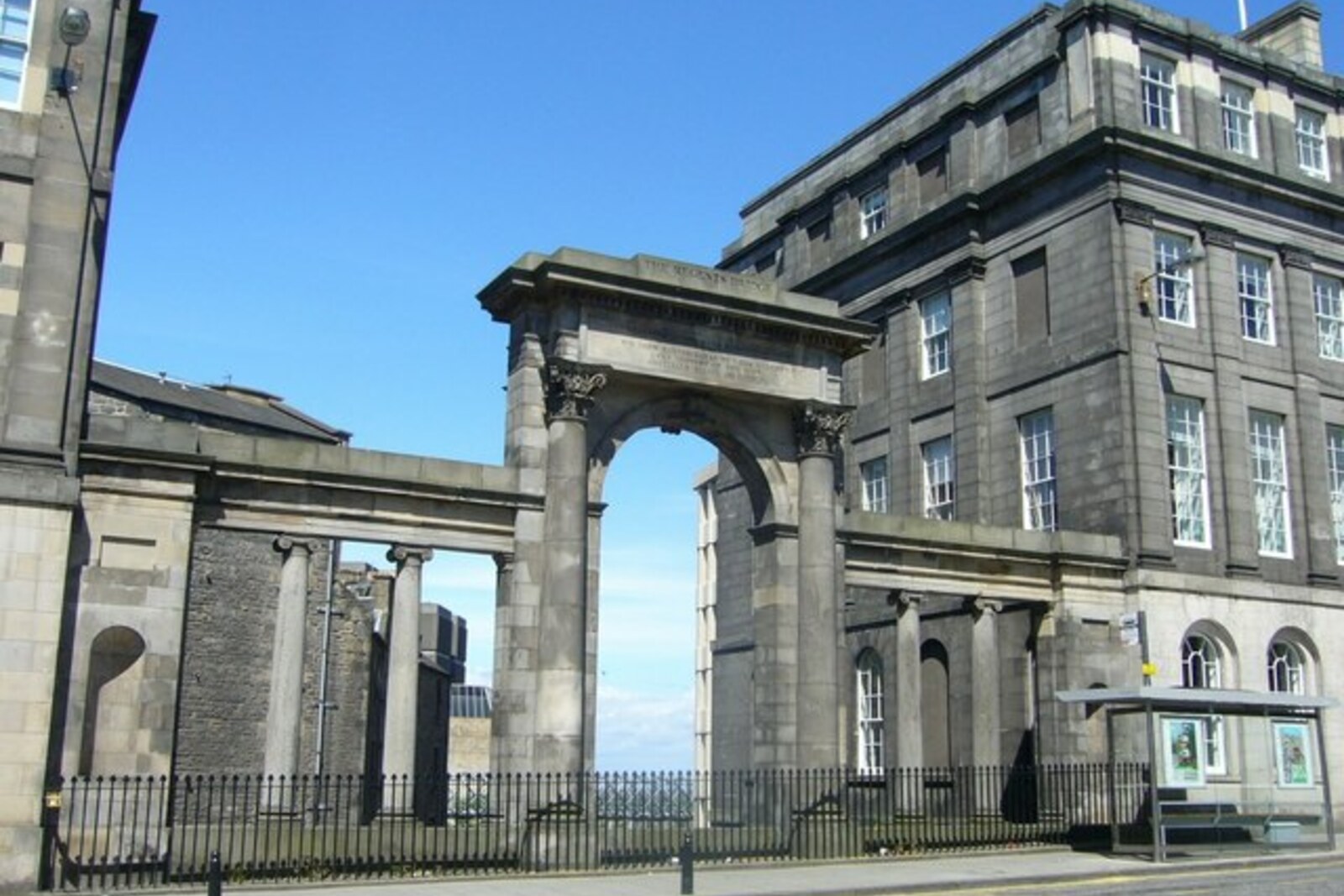
Look around first
What to notice
- Stone arch above Calton Road
- Northern panel with inscription
- High retaining walls
- Divided sections of the burial ground
The story of the place
Waterloo Place lies above the former dip of Low Calton: below, Calton Road passes through a stone arch, while the roadway above continues the city street. This cut once broke the route from Princes Street to the eastern road to Berwick-upon-Tweed and England; the bridge linked the center with new districts and the approach to the prison on the slope. Part of the Old Calton Burial Ground was moved for this route, and the remaining graves ended up on opposite sides of the road behind high retaining walls.
On September nineteenth, eighteen fifteen, John Marjoribanks stood above the deep Low Calton as the first stone of the new bridge was laid. His term as Lord Provost—the elected head of Edinburgh—was nearing its end. Before joining the town council, Marjoribanks had been a co-owner of a bank; now he was risking his own money to build a road where an earlier attempt had failed because of the cost.
Princes Street then ended at the dip by Calton Hill. Beyond it began an awkward approach to the eastern road leading through Berwick-upon-Tweed to England. A new prison was to be built on the slope, but it too needed proper access. On March first, eighteen fourteen, Marjoribanks brought the city magistrates a plan: to throw a bridge across the dip, extend Princes Street, and, with one structure, open access to the prison, new districts, and the road to London. The engineer Robert Stevenson confirmed that the idea was feasible.
Marjoribanks had to negotiate with the Incorporation of the United Trades of Calton. The tradesmen owned the old burial ground directly in the path of the planned street. They agreed to give up the land after the city promised another plot, financial compensation, and a new meeting hall to replace the one being demolished. During the earthworks, the remains were moved to New Calton Burial Ground in carts covered with white funeral cloths. The surviving part of the old burial ground was cut in two by the road; this accounts for the high retaining walls and the separate section of graves on the other side of Waterloo Place.
Contemporaries wrote that Marjoribanks made a serious dent in his personal funds for the construction, expecting to recover his investment later. He did not receive the expected profit. But in eighteen nineteen, a direct entrance to the center was opened across the bridge. The stone arch remained below, above Calton Road, so from the level of the Waterloo Place roadway it is easy to miss that the carriageway crosses the former dip.
Both names appeared in the years when Great Britain was ruled, in place of the seriously ill George III, by his son, the Prince Regent George, the future George IV. His title survives in the name Regent Bridge. Waterloo Place was named in memory of the victory of the British and allied armies over Napoleon at the Battle of Waterloo on June eighteenth, eighteen fifteen.
Marjoribanks was involved in that name as well. When news of the victory reached London, he was there as a member of parliament and hired a fast carriage to bring the news to Edinburgh as quickly as possible. The northern stone panel of the bridge is inscribed: “Begun in the memorable year eighteen fifteen.” Below are the names of Lord Provost John Marjoribanks and the architect Archibald Elliot; beneath the panel, Calton Road still passes through the arch, while above it lies the street named for the news that Marjoribanks sent to the city.
Useful on site
Open around the clock
Checked: June 17, 2026. Check the official source before visiting.View the bridge and the burial grounds from the regular sidewalks; you do not need to go down beneath the roadway or enter among the graves to understand this stop.