 Guide On Map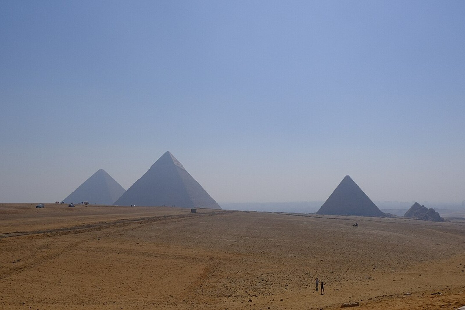
Look around first
What to notice
- The three main pyramids
- A strip of desert plateau
- Horses
- Camels
The story of the place
The panoramic viewpoint was created for a single angle. From the southwestern edge of the plateau, the three main pyramids fit into one frame: the Pyramid of Menkaure stands closest, with the pyramids of Khafre and Khufu rising behind it. Tour groups come here for this sequence, horse rides begin here, and photographs are taken in which a strip of desert plateau remains between the camera and the pyramids.
One of the first commercially successful versions of this view was made in eighteen fifty-eight by the British photographer Francis Frith. Before taking up photography, he traded in groceries and sold his profitable business so that he could travel through Egypt with a camera. Frith wanted to provide accurate images of antiquities to buyers who would not reach the Nile themselves. His future income depended on the chosen viewpoint: the photographs were to be printed and sold by subscription.
The photographer needed a large camera, a glass plate, and a portable wicker darkroom. At the time, enlarging negatives was hardly possible, so the glass had to be the same size as the future print. Frith coated the plate with light-sensitive collodion, placed it in the camera, exposed it, and developed it while the coating remained wet. If it dried, the work was lost. The southwestern view had to be made entirely here, among the stones: it was impossible to take the plate away and deal with it later.
In the photograph, Frith left two seated men and a horse in front of the pyramids. Their small figures give the structures scale, while the diagonal arrangement turns three separate royal complexes into one recognizable picture. The Egyptian series sold well; its success allowed the photographer to travel to the Middle East twice more, then establish a publishing house that produced landscape and architectural views.
Later, designers of the tourist route selected special panoramic points on the heights of the plateau: visitors gained distant views, while fewer people gathered near vulnerable monuments. Nothing remains here of Frith's camera or wicker darkroom. The arrangement of his photograph remains. Now camel and horse owners earn money here by offering travelers the chance to take the place of those two small figures in front of the three pyramids.
Useful on site
An open site within the Giza Plateau; access depends on the general ticket, shuttle routes, and the time of last entry.
Checked: June 28, 2026. Check the official source before visiting.Protect your lens from sand and do not leave the marked areas for a photograph. Take one picture with figures below: without them, the scale is easily lost.