 Guide On Map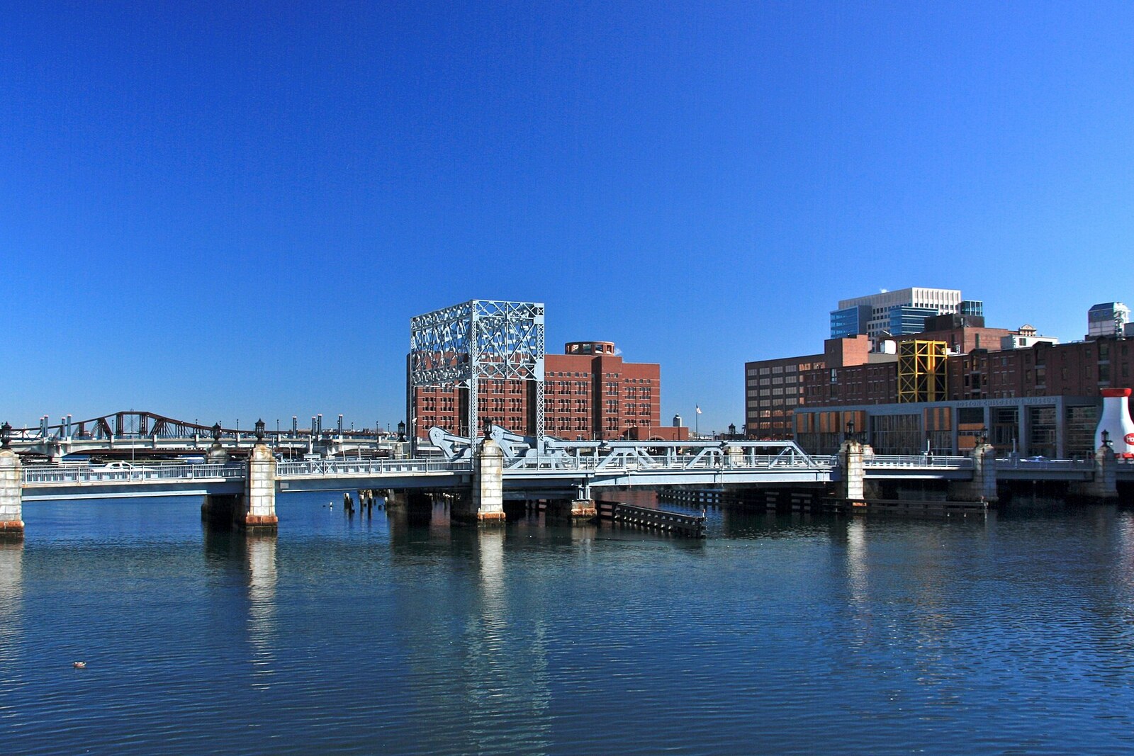
Look around first
What to notice
- Steel lift frame
- Bridge operator’s house
- Fort Point Channel
- Brick buildings beyond the channel
The story of the place
A steel frame of a lift bridge hangs above the narrow Fort Point Channel. Its counterweights are gone, so the span no longer rises; beside it, the small operator’s house remains, now associated with the museum. Across the water, brick buildings stretch along Congress Street, and beneath the roadway there was once a wide passage left for ships.
In eighteen thirty-six, entrepreneurs founded the Boston Wharf Company to build warehouses and wharves on the muddy flats of South Boston. In the middle of the century, its director became Elisha Atkins, a sugar importer and co-owner of the Bay State Sugar Refinery. He sought a convenient place where imported sugar and molasses could be kept until customs duty was paid. Atkins and his partners made money from this storage business.
By order of the directors, stone walls were built along the water, and the flats behind them were filled in. For sugar, they put up one-story wooden sheds inside courtyards enclosed by high fences. Water was still needed: ships had to come directly up to the warehouses. This is how the natural tidal passage between Boston Harbor and South Bay acquired the straight banks of today’s channel.
The name Fort Point came from the other shore. There were fortifications there, and Fort Hill rose above them. Between eighteen sixty-six and eighteen seventy-two, the hill was leveled, and its earth was used to fill in the shoreline. Later, even debris from buildings after the Great Boston Fire of eighteen seventy-two was brought here. The fort and the hill have long been gone, but part of Fort Hill remains underfoot in the district that bears its name.
One thing troubled the company’s directors: the northern part of their holdings was separated from downtown by the channel. When the state withdrew permission for further filling in eighteen sixty-seven, they filed a lawsuit. They had managed to sell the disputed tract to a railroad company, but it went bankrupt. The land had been mortgaged to the previous owner and returned to the Boston Wharf Company. The promise to build a city bridge here persuaded the directors to keep the tract and continue the work.
The first swing bridge opened in eighteen seventy-five, while the filling was still unfinished. Eastern Avenue was laid through the company’s property to reach it; later, it was made an extension of the already existing Congress Street. The name refers to the United States Congress: the street received this national name as early as eighteen hundred. No session ever took place on the shore of the channel.
By eighteen eighty, the company had seventeen sheds for sugar and molasses. Then sugar refineries began storing their own raw materials, and the warehouse owners’ income fell. The directors used the new bridge for another business: they began leasing land and buildings to industrial tenants. In eighteen eighty-two, at the bridge’s eastern end, they built Dorr's Stores, the district’s first brick warehouse, already intended for wool, cotton, and various goods. Other brick buildings rose behind it along Congress Street.
The present bridge appeared by nineteen thirty-one. City engineers replaced the old swing span with an electric lift span: a passage about twenty-three meters wide was meant to admit larger ships and support the fading trade on the channel. Cargo was already moving to railroads and automobiles. In nineteen seventy, the bridge was opened only twice, for a pleasure vessel heading to a waterfront restaurant that, as officials dryly noted, did not even have a real pier.
Now the counterweight has been removed, and the lifting mechanism no longer works. The tall steel frame above the roadway remains empty. The operator’s house is included in the complex of the Boston Tea Party Ships & Museum. The first brick warehouse, Dorr's Stores, is no longer at the bridge exit; the buildings constructed after it stand farther along Congress Street.
Useful on site
Open city bridge; temporary detours are possible because of roadwork in Fort Point.
Checked: June 30, 2026. Check the official source before visiting.View the structure from the sidewalk and do not linger by the roadway; the internal mechanisms are only partly accessible from outside.