 Guide On Map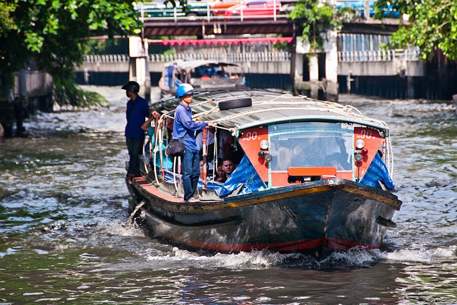
Look around first
What to notice
- Passenger boats
- Houses by the water
- Pedestrian bridge
The story of the place
Farther east of Baan Krua, excavators laid out more than fifty kilometers of channel, while the water by the bank became the urban approach to this new waterway. Chinese work crews were paid for completed sections, including earth excavation and stump clearing; alongside them worked resettlers from different lands of Siam. The canal was intended for heavily loaded boats, and today's houses, bridge, and passenger boats still stand along this old corridor.
At Baan Krua, passenger boats enter almost the very center of Bangkok along a narrow strip of water between houses. No roads are needed for this route: the canal stretches east toward Bang Kapi and beyond, while to the west it connects with the old Khlong Mahanak, which leads to the city moat. It is at Baan Krua that the two waterways form a single line.
This line was put together during the Siamese–Vietnamese War—a long struggle between Siam and Vietnam for control of Cambodia. Armies went far to the east, but soldiers needed rice, weapons, and gunpowder. Carrying all this overland across the plain was slow. In eighteen thirty-seven, the Siamese king Rama III ordered the existing waterway extended to the Bang Pakong River, from where a route opened to the eastern provinces and the Cambodian border.
The work was directed by the court official That Bunnag. His task was to hire excavators and produce a canal that loaded boats could pass through. Chinese work crews were paid for each completed section: seventy baht for every forty meters. This sum included digging out the earth and clearing stumps. Alongside the hired Chinese worked people whom earlier campaigns had brought to Siam from Khmer, Malay, Lao, and Mon lands; Cham people also took part in laying out the route.
In a little over four years, the workers cut more than fifty kilometers from Hua Mak to Bang Khanak. The documented construction began far east of Baan Krua: the water before you was the western approach to the new canal. But it was through this section that boats from the capital entered the excavated route. By the end of eighteen forty, people and military cargo could already be carried along it.
After the war, boatmen carried rice and sugar from the eastern fields along the same route. Some resettled families received land along the water and took up farming; the Cham families of Baan Krua remained at the urban end of the route. Thus the military road acquired ordinary permanent users before the need for military transport disappeared.
The chronicle adds one more detail: by the time the work was completed, ordinary townspeople already called the canal Saen Saep, but it does not explain the origin of the name. The story of the “hundred thousand bites” of local mosquitoes remains a folk interpretation. Another version derives the name from Khmer words meaning fresh water; it is connected with the Khmer and Cham speech of people who lived along the route, but it cannot be considered proven either.
Today, the name Saen Saep has also been extended to the passenger route west of the historic construction. At Baan Krua, the boats pass that very junction: in one direction lies the old Khlong Mahanak, and in the other, the canal that That Bunnag and the work crews he hired extended to the route east.
Useful on site
The canal bank is open as an urban public space; boats usually run Mon–Fri 06:00–20:00, Sat 06:00–19:00, Sun 07:00–18:00.
Checked: June 28, 2026. Check the official source before visiting.Keep away from the edge and allow for waves and spray from passing boats.