 Guide On Map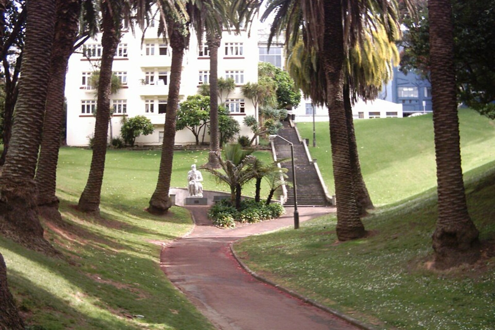
Look around first
What to notice
- Deep green hollow
- Brick kindergarten building
- Palm-lined alley
- Staircase to the arcade
The story of the place
Myers Park occupies a deep green hollow beside Karangahape Road: paths run along its bottom, lawns and playgrounds lie among the palms, and a staircase leads to the arcade. Houses for working families once crowded the slopes. At the bottom stands a brick building with a communal hall, sliding partitions, and doors leading directly onto the grass. A kindergarten established for preschoolers from low-income artisan families still operates here.
The park's narrow hollow is the upper part of the Te Waihorotiu valley. The stream began here, passed through the marshy lowland on the site of today's Aotea Square, and descended to the harbor along what would become Queen Street. European settlers began calling it the Ligar Canal—the same watercourse, now turned into an open sewage drain. City engineers gradually enclosed it in brick culverts. Beneath the park, archaeologists have found drainage channels built as early as the eighteen eighties.
Houses for working families crowded the slopes above the hidden stream. By the beginning of the twentieth century, municipal officials described this development as slums, but a decision to clear it was not enough: the city council had to buy many privately owned plots.
In nineteen thirteen, Mayor Christopher Parr approached Arthur Myers—a former mayor, member of parliament, and head of a large brewing company. Myers's wealth came from his share in the family business: when Myers was sixteen, his uncle took him out of school to work, and by thirty had handed him management of the amalgamated company. Parr now proposed investing some of that money in turning the ravine into a public park.
Parr named the required sum: nine thousand pounds. The city could not afford such an expense, and Myers paid for the land purchases. Several houses were demolished, the bottom of the hollow was cleared, and paths, lawns, a playground, and shallow pools for children's play were laid out. The council gave the new park its donor's name.
When the park opened in January nineteen fifteen, hundreds of children from the surrounding neighborhoods were among those gathered. Myers announced that he wanted to give them this space, and immediately added another four thousand pounds for a free kindergarten for preschoolers from low-income artisan families. A year later, a brick building opened in the lower part of the park, with a large communal hall, sliding partitions, and doors leading directly onto the lawn.
This kindergarten continues to operate in the same building. Beneath its windows, the water of Te Waihorotiu enters a culvert toward Queen Street, while children still spend their days above the hidden channel.
Useful on site
Open park; water-play area in summer 10:00-20:00, Waimahara is open 24 hours, but after dark take the usual city precautions.
Checked: June 28, 2026. Check the official source before visiting.The descent here is noticeable, so stay on the paths and save your strength for the return to the ridge. Waihorotiu Stream is enclosed underground: you can see the landscape it created, but not the water itself.