 Guide On Map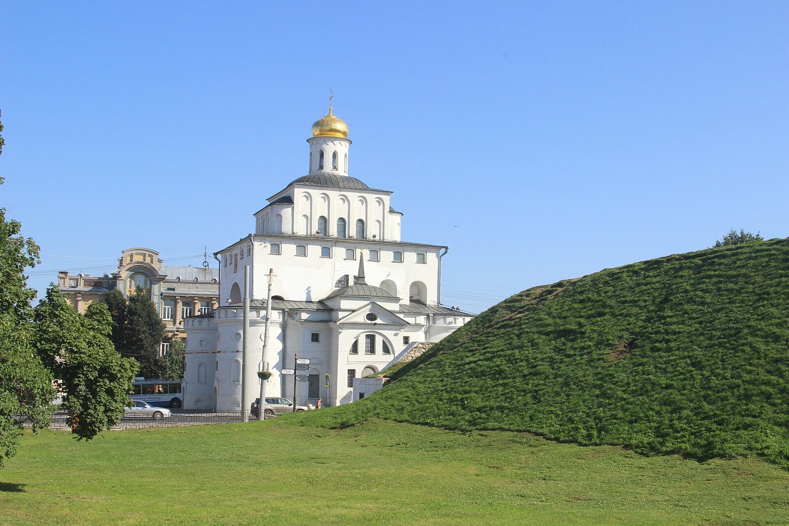
Look around first
What to notice
- Earthen ridge
- Steep slope
- Walking path
The story of the place
Beneath your feet stretches a steep earthen ridge, now followed by a walking path. In the twelfth century, when Vladimir was being expanded and fortified, a defensive line was laid out here south of the Golden Gate. A wooden wall crowned it, and a ditch lay at its foot: this is how this side of the city was protected.
On the night of April seventeenth to eighteenth, eighteen seventy-four, the city boulevard on Kozlov Rampart was wrecked. Unknown people broke the benches, tables, and gazebos. A few years earlier, all of this had been paid for by Nikolai Borovetsky, a Vladimir merchant and member of the city council, who had decided to turn the abandoned embankment into a place for walking.
Borovetsky made his money from the vegetable trade, a shop, a wine store, and a wholesale warehouse. He invested part of his income in a plot where sand and clay had previously been extracted and trash dumped. A garden was planted on the ridge, and lattice gates, gazebos, tables, and benches were installed. The height of the former fortification made it possible to see the city and the Klyazma floodplain, so the walking boulevard was laid out here. An admission fee was charged and given to the Red Cross.
After the wrecking, Borovetsky placed a notice in the newspaper offering a reward and repeated it twice. According to the surviving records, the culprits were never found. The boulevard, however, continued to host festivities, music, and fireworks. When the merchant died in eighteen eighty, an obituary called this garden a monument created by him, and for a time the townspeople called it “Borovetsky Boulevard.” The name did not stick.
Kozlov Rampart acquired its name earlier. The embankment itself appeared as early as the twelfth century, when Prince Andrei Bogolyubsky was expanding and fortifying Vladimir. An earthen ridge, with a wooden wall on top and a ditch at its foot, protected the section south of the Golden Gate. By the eighteenth century, defense was no longer needed here. Townspeople laid roads through the rampart, dug garden beds, and cultivated apple and cherry orchards.
In seventeen twenty-nine, the overseer of the fortifications inspected this land. He recorded washouts, paths, and the garden of a posad man, Aleksei Fedotovich Kozlov. A posad man was an urban taxpayer from an unprivileged estate; for Kozlov, the garden was a purchased working plot. It extended forty-three sazhen along the ridge—about ninety meters. The overseer could not determine its width: inside the garden, the rampart had been leveled.
Kozlov was summoned for questioning. He explained that he had acquired the garden, already planted, in seventeen oh three and did not know who had first planted trees here. Other townspeople confirmed that gardens and vegetable plots had existed on the fortifications at least since the end of the seventeenth century. The documents do not mention any punishment for Kozlov. His surname, however, remained attached to the plot.
Nothing remains here of Kozlov’s garden, Borovetsky’s lattice gates, or his gazebos. What remains are the earthen embankment and the walking path along its ridge—Kozlov Rampart.
Useful on site
Open urban space; the “Old Vladimir” exhibition in the neighboring water tower has been closed since June 22, 2026.
Checked: June 24, 2026. Check the official source before visiting.Watch your step on the ascent and descent; after rain, the ground and grass may be slippery.