 Guide On Map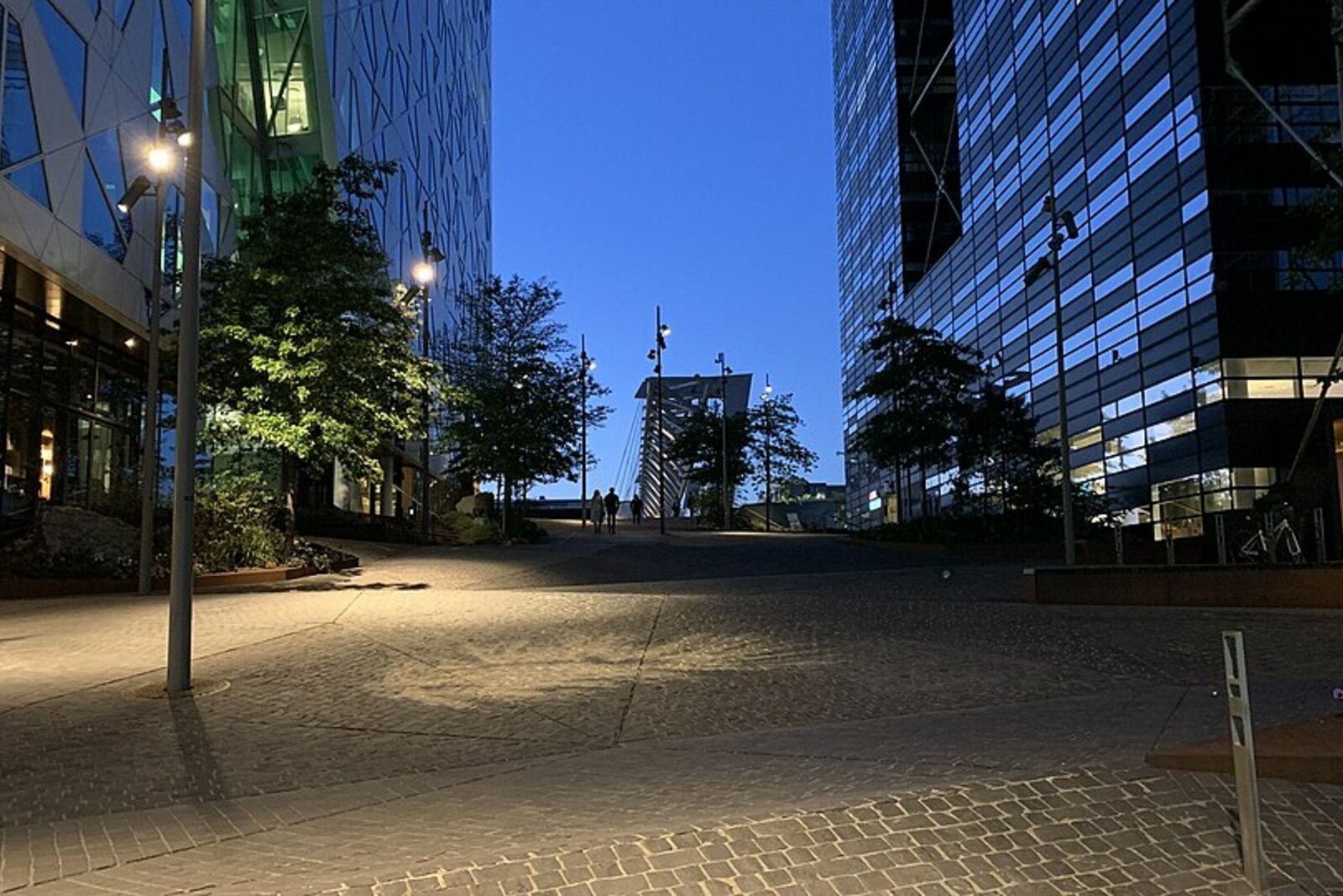
Look around first
What to notice
- The bridge’s steel truss
- Slender suspension rods
- Barcode’s narrow buildings
- The boat behind glass
The story of the place
Pedestrians and cyclists were taken here over nineteen active railway tracks. The steel truss rises high above the passage, and the deck is held by slender rods: there was room for supports at only four points. The bridge’s southern exit leads into Barcode, where narrow buildings of varying heights are arranged with gaps opening toward the fjord; offices operate inside them, apartments have been created, and cafés and shops are open. Before the shore was extended, there was a harbor here.
In April two thousand eight, builders of DNB’s future headquarters had to stop excavation. In the clay lay an oak hull flattened by the earth. Archaeologists from the Norwegian Maritime Museum soon counted thirteen boats and vessels from the late sixteenth and early seventeenth centuries here. The best preserved was a boat given the working name Barcode 6.
The modern Barcode gave the find its name. In two thousand three, three architectural firms won the competition to develop the strip between the railway station and the fjord. They offered the client not a finished row of buildings but a set of rules: narrow buildings of varying heights, with gaps between them opening toward the water. The result was a barcode pattern. More than ten thousand people now work in twelve buildings, nearly four hundred apartments have been created, and the ground floors are occupied by shops and cafés.
The architects built on land, but before the shore was filled in, there was a harbor here. The oak for Barcode 6 was felled near Oslo in fifteen ninety-five. It was a short, wide cargo boat with oars and a square sail. Its owners repaired it and then altered the stern: they replaced the pointed end with a flat transom. For the owner of a small vessel, capacity meant income. The Researchers believe that after the alteration the boat could carry noticeably more cargo, although the exact reason for the decision can no longer be determined.
When the vessel had served its purpose, harbor workers sank it together with other old boats and filled the hulls with earth and stone. That was how they extended the shore: what was no longer fit for sailing became the foundation of the harbor. A layer of soot from the fire of sixteen twenty-four sealed the hull from above.
Four centuries later, Terje Planke, a curator at the Norwegian Maritime Museum, tried to reconstruct the find’s design, while Lars Stølegård, a specially invited master of traditional boatbuilding, was to build a working replica. Stølegård earned his living precisely through his knowledge of old wooden boats; if the wrong hull shape were accepted, the full-scale vessel would turn out false.
At first, both believed the stern had been pointed. But the grooves on the surviving parts did not match the hull planks. Another set of grooves fit, left over from the alteration. Then archaeologists found a complete stern transom from a similar vessel nearby. Planke and Stølegård realized that they had before them the oldest known boat in Scandinavia with overlapping side planks and a flat stern.
In two thousand eleven, the master launched a full-scale replica called Våghals. The DNB Savings Bank Foundation granted the museum five million kroner to preserve the original. Its parts were assembled for a permanent exhibition near the place where builders uncovered the old harbor: the boat is visible behind glass between the bank buildings.
Akrobaten Bridge opened in the same year, two thousand eleven. Its name means “acrobat” and refers to the structure itself. Engineers needed to take pedestrians and cyclists over nineteen active railway tracks, while supports were permitted in only four places. So the main steel truss was raised above the passage, and the deck was suspended from it on slender rods.
The southern end of Akrobaten Bridge leads out between the strips of Barcode. Beneath this line once lay the shore that harbor workers extended with sunken vessels; Barcode 6 now stands behind glass just a few steps from the ground where it was left.
Useful on site
An open urban space with no visiting hours; strong winds on the bridge and near the gaps between the buildings are common.
Checked: June 15, 2026. Check the official source before visiting.On the bridge, do not block the passage and watch for cyclists. In wind, rain, or icy conditions, view Barcode from a stable area at street level.