 Guide On Map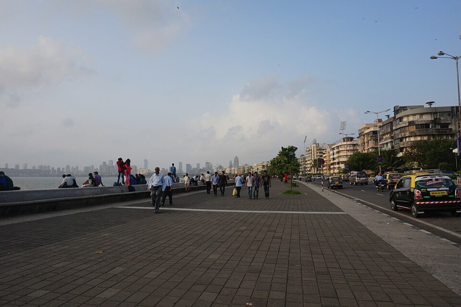
Look around first
What to notice
- Low stone parapet
- Six-lane road
- Unbroken row of Art Deco buildings
- Curve of the promenade
The story of the place
The coastal curve runs along a narrow strip of reclaimed land beside Back Bay. A new district with institutions, gardens, and housing was originally planned here, but the seaward side was ultimately given over to a road and an open promenade. The low stone barrier keeps the water very close, while behind it the continuous line of Art Deco buildings gathers the curve into an urban façade. At the south, it reaches Nariman Point, beyond which begins the next, business section of land created near the sea.
A low stone parapet runs along the sea, where people sit facing the water. Beyond it are six lanes of road, and farther on stands an unbroken row of Art Deco buildings. The municipality officially calls this road Netaji Subhash Chandra Bose Road. “Netaji” means “respected leader”: Bose sought India’s independence and led the armed struggle against British rule. Yet residents have kept the familiar name Marine Drive for the promenade—a sea road.
Builders shaped the present shoreline in stages. The section opposite Churchgate arose from a project that was meant to push the sea much farther back. In nineteen eighteen, two private groups proposed filling in part of Back Bay at their own expense. Bombay Governor George Lloyd reasoned that the revenue from selling the new land should go to the treasury, and he placed the project under state control. New institutions, gardens, and housing were promised, though the most expensive plots were intended for wealthy buyers.
The calculations were entrusted to the port engineer George Buchanan. He proposed creating one thousand one hundred forty-five acres of land and estimated the work at thirty-seven million rupees. The chief tool was to be a dredger: it was designed for soft ground and expected to extract two thousand cubic yards an hour. Buchanan did not require test drilling and approved the purchase of the machine without testing it in Bombay Harbour.
Dense clay lay underwater. The dredger stood idle for twenty-one months, and once started, it delivered barely more than half the promised output. About nine hundred thousand cubic yards of fill flowed back into the bay through an insufficiently solid sea wall. Just one year later, the estimate was raised to seventy million rupees. By nineteen twenty-six, it was calculated that at that pace the work would not be completed until nineteen forty-five and would cost one hundred ten million.
Khurshed Framji Nariman began extracting these figures from departmental papers. A member of the legislative council, he sought an open inquiry. He earned his living as a lawyer at the police court. He was not a privileged British barrister: officials stressed that Nariman was merely a local court defender, and even hinted that constant work with defendants prevented him from judging fairly.
Nariman published analyses of the estimates in the Bombay Chronicle and demanded an examination of the entire construction department. When he was offered a place on an advisory commission that was forbidden from examining the work of the department itself, he refused. The campaign nevertheless led to an official inquiry. At its hearings, Nariman argued that they were trying to make the engineer the sole culprit, although the governor had begun the undertaking without full oversight from the legislative council.
The engineer Thomas Harvey, whose name was mentioned in testimony, secured the opening of a libel case. For Nariman, a conviction would have damaged the reputation on which his legal practice depended. He defended himself in the police court and spent more than a year examining bills, contracts, and employees’ testimony. In January nineteen twenty-eight, the court acquitted him: Nariman had made the accusations in good faith and had not been pursuing Harvey personally. A few years later, he became mayor of Bombay.
After the inquiry, the government reduced the project. By nineteen twenty-nine, only four of the eight planned sections had been completed; part of the reclaimed land was allocated to Marine Drive and its sea wall. That is why a comparatively narrow strip of road and public promenade runs along the bay, rather than the continuous new district Lloyd and Buchanan had envisioned.
At the south, the curve ends at Nariman Point. The business district later created on the next reclaimed section was named after Khurshed Nariman. The road reaches the point named after the lawyer who forced its original plan to be stopped.
Useful on site
A public promenade for an outdoor walk; no special access hours have been found.
Checked: June 28, 2026. Check the official source before visiting.This is the beginning of the longest open stretch. Stay on the pedestrian section, and take the sun, rain, and fatigue into account; stories about apartments do not involve visiting residential buildings.