 Guide On Map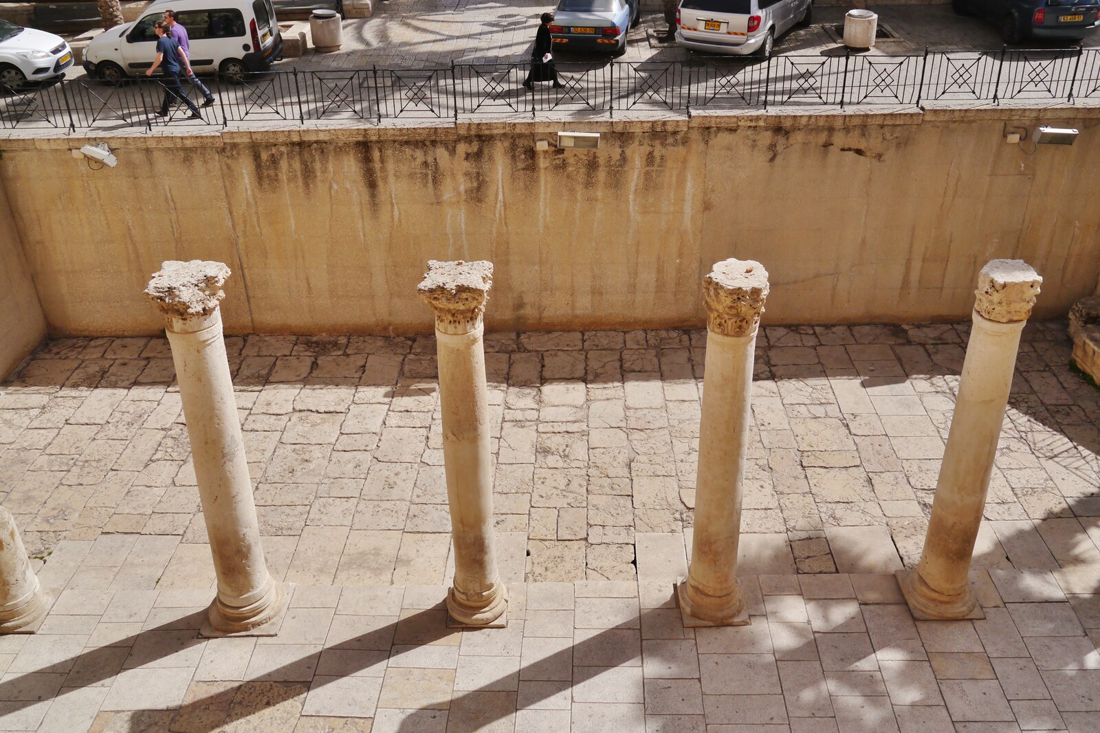
Look around first
What to notice
- Stone slabs
- Limestone column bases
- Reconstructed colonnade
- Concrete vaults
The story of the place
In the sixth century, the city's main thoroughfare was extended through this place to a large Church of the Mother of God in southern Jerusalem. A broad carriageway ran down the middle, roofed pedestrian galleries stretched along the sides, and shops traded behind limestone columns. The stone slabs were laid directly on bedrock: no earlier Roman pavement was found beneath them. The reconstructed row of columns helps convey the street's former width.
In nineteen seventy-one, the young architects Peter Bogod and Esther Niv-Krendel were still employed at the studio of the landscape architect Shlomo Aronson. Together, they entered a competition: a hotel, apartments, and shops had to fit into a two-hundred-meter strip between Chabad Street and HaYehudim Street. Nothing was yet visible underground.
The three architects studied a sixth-century mosaic map found in a church in the Jordanian city of Madaba. It showed Jerusalem crossed by a broad street with two rows of columns. This was the Cardo—the name used in Roman cities for a street running from north to south; the main Cardo served as a road, a market, and a place for urban processions. Bogod, Niv-Krendel, and Aronson decided that the competition site lay directly above its continuation. They proposed finding the ancient pavement, giving the lower level over to commerce, and raising the housing above it.
Their design beat twenty-seven competitors, but the client doubted that such a scheme could be built at all. The architects had to make a three-dimensional model to obtain permission to work. After the victory, Bogod and Niv-Krendel left the studio and took on the project independently. In the end, it took twelve years of their lives.
The archaeological excavations in the quarter were led by Nahman Avigad, a professor at the Hebrew University of Jerusalem. He was over sixty: for this work, he gave up a planned vacation before his imminent retirement. According to Bogod's recollection, Avigad initially laughed at the young architects' assumption. No pavement or columns remained on the surface, and the mosaic from Madaba was an image of the city, not a construction drawing.
Yet Avigad laid out thirteen test pits along the presumed line. Each one came up against a solid layer a little more than two meters down. When the archaeologists expanded the excavation, column bases emerged from the ground one after another, spaced at equal intervals. Beside them ran a drain, into which water had once flowed from roofs above the side passages. The street on the mosaic map lay beneath the competition site.
This southern section of the Cardo was laid out in the sixth century. Archaeologists found no earlier Roman pavement beneath it: the stone slabs lay directly on bedrock. The researchers therefore associate its construction with Emperor Justinian I, who built the enormous Church of the Mother of God—the Nea Church—in the south of the city. For residents and pilgrims, the main street was extended to the new church; from here, they could walk along the colonnade to the Church of the Holy Sepulchre. A broad carriageway was left in the middle, covered sidewalks were laid out on either side, and shops opened beyond the columns. The Nea Church later almost disappeared, but the builders laid the road where the mosaic makers had shown it.
The excavations delayed the construction of the houses, while the client demanded that the housing be completed as quickly as possible. Bogod and Niv-Krendel changed the drawings as new columns and walls appeared. Instead of filling in the finds, they covered the site with a system of concrete vaults. Archaeologists continued working below, while above them builders laid out courtyards and constructed about forty apartments around them. Shops once again occupied the lower floor.
The gray concrete here was left exposed and finished by hand. The architects wanted their columns, arches, and supports to be impossible to mistake for ancient ones. Thus, the stone slabs underfoot and the surviving limestone bases belong to the sixth-century Cardo, the reconstructed fragments of the colonnade show its former width, and the concrete vaults support the houses built above the excavation. Between Chabad Street and HaYehudim Street runs the very line for which two architects left the studio and an elderly archaeologist postponed retirement.
Useful on site
An open urban passage with retail sections; access is usually daily.
Checked: June 27, 2026. Check the official source before visiting.Compare the levels without blocking the stairs and shop entrances; commerce here is part of a functioning street.