 Guide On Map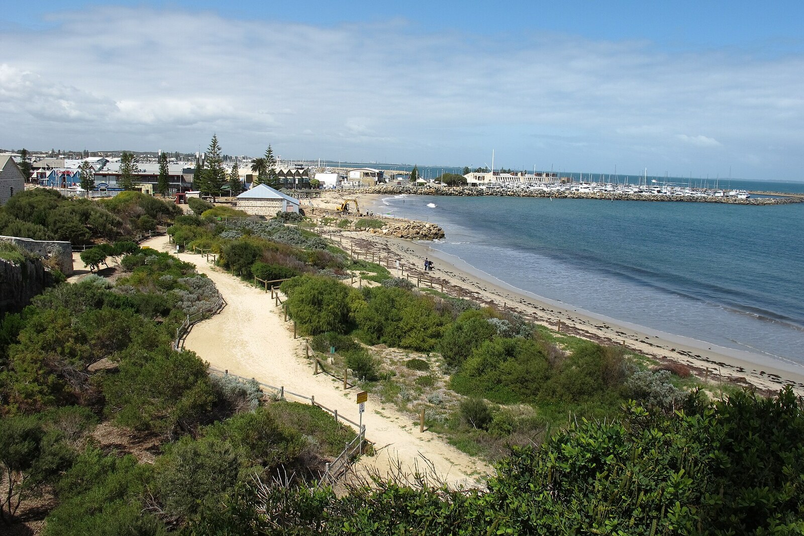
Look around first
What to notice
- The sandy strip of Bathers Beach
- The limestone headland of Arthur Head
- Kidogo Arthouse
- The beginning of the Manjaree Trail
The story of the place
On the sandy shore by limestone Arthur Head, right at the river mouth, British settlers established the first camp of the new settlement. Later, whaling operations, boat workshops, and port buildings appeared by the water. Manjaree referred to an area broader than the present beach: it included the shore itself, the headland, and the land by the river. The shoreline was later cut away, filled in, and rebuilt, so the old camp sites can no longer be identified precisely.
This sandy shore is Bathers Beach at the river mouth. In the shallows, women and children lined up with branches and drove a school of fish toward the shore. The men met the fish with spears. Groups of two dozen people and more took part in this kind of fishing: a large catch was needed to feed families who had come here from different parts of Noongar Country.
The local Whadjuk and their neighbors gathered at Arthur Head for manjar—a fair where exchange was accompanied by ceremonies. Some brought hunting weapons, others clothing, ornaments, and food supplies. Elders discussed laws and kinship obligations. Mothers and fathers brought young men and women who had reached marriageable age so they could meet their future spouses. After such a gathering, goods passed to new owners, and families became connected through marriages.
People chose this shore because of the routes and the food. Three major trails met here, biddi in Noongar: from the north along the river, from the lands by the Canning River, and from the south, from the Murray River area. In summer, the coastal ground was drier, fish were running in the estuary and sheltered bays, and a source of fresh water lay nearby. Everything needed for a large gathering could be obtained close at hand.
The name Manjaree comes from the word “manjar.” It is translated both as “meeting place” and as “fair exchange.” The difference is connected with the fact that the Noongar language remained oral for a long time, and Europeans recorded what they heard in different ways. The name itself referred to an area broader than today’s strip of sand: the shore, the limestone headland of Arthur Head, and the space near the river mouth.
After British settlers landed in eighteen twenty-nine, the first camp of the new settlement was established here. Then whalers, boat workshops, and port facilities occupied the shore. It was called Whalers Beach, in the nineteen thirties and nineteen forties City Beach, and the present English name Bathers Beach means “beach of bathers.”
The exact location of the former camps and ceremonial grounds can no longer be determined: the shoreline was cut away, filled in, and rebuilt. The Manjaree Trail begins at Kidogo Arthouse, and the strip of sand beneath it is still marked on maps as Bathers Beach.
Useful on site
Public shoreline with no fixed hours; individual establishments operate on their own schedules.
Checked: date not specified. Check the official source before visiting.Listen to the story from the promenade or a stable section of the beach, without obstructing the way down to the water. Swimming is not required to complete the route.