 Guide On Map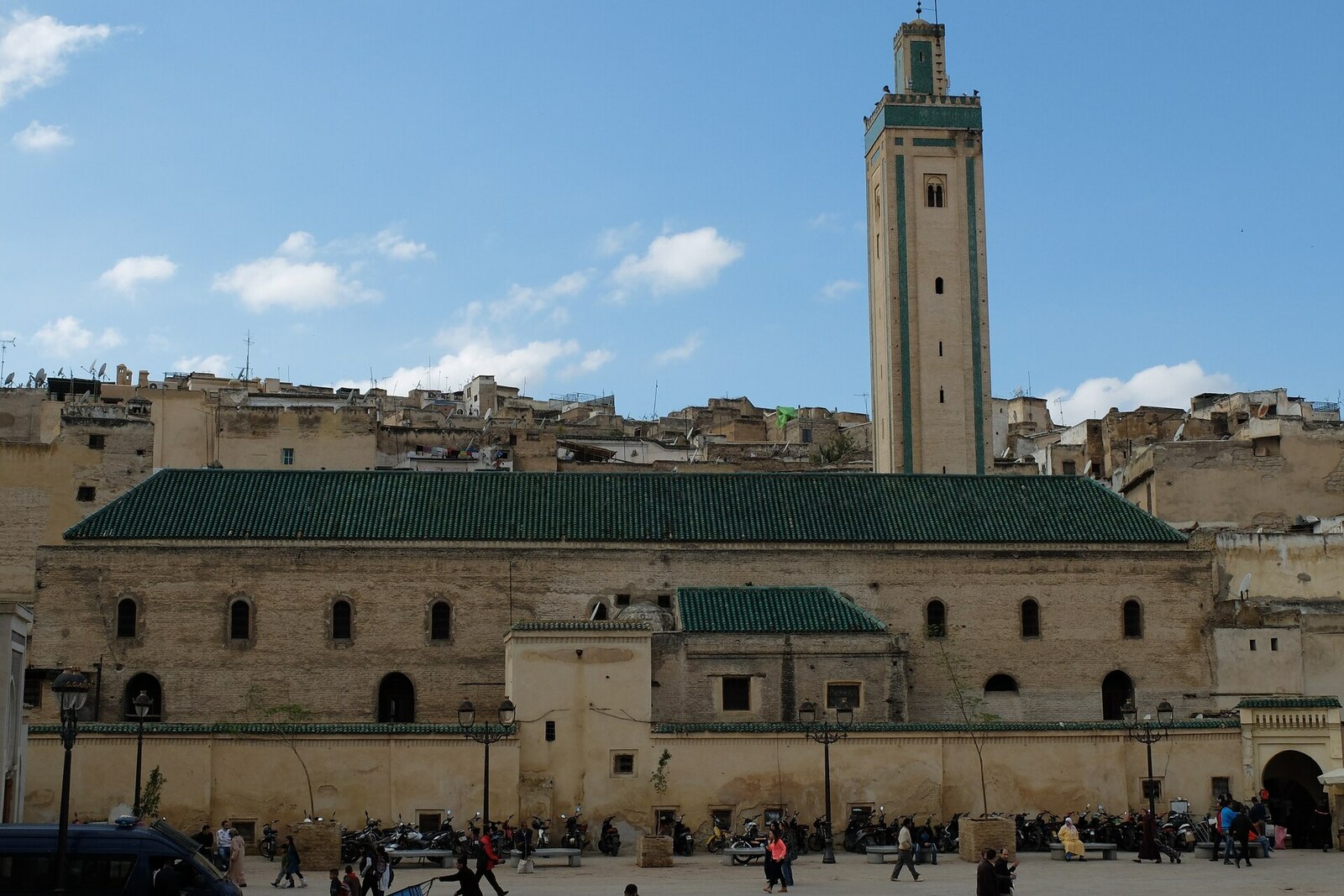
Look around first
What to notice
- Automobile road
- Square paving
- Edge of pedestrian alleys
- Space for vehicles
The story of the place
The paving is broad by the medina’s standards, with room for cars, but narrow pedestrian passageways immediately branch off from its edges. This area was completed in the nineteen sixties, when access to the commercial quarters was sought without cutting new streets through the old built-up fabric. This stretch thus became a rare boundary between city transport and the medina, which remains pedestrian beyond it.
Place Rcif means “paved road.” This was the name of the neighboring Rcif Mosque long before the present square appeared. The mosque then stood above the open bank of Oued Bou Khrareb. The channel now runs beneath the paving, and one of the few roads for cars inside the medina ends right here.
The choice of this route grew out of the needs of local traders. By the middle of the twentieth century, every bale of goods had to be carried deep into the medina on a pack animal: cars could not get through the alleys. For shopkeepers who made their living by selling goods delivered here, this was a daily limit on their trade. At the same time, Oued Bou Khrareb, in the lowest part of the city, received wastewater and garbage. Residents demanded both proper deliveries and a sanitation solution.
In the late nineteen forties, Morocco was under the French Protectorate in Morocco, and two of its departments proposed opposing solutions. Michel Écochard, head of the town-planning department, wanted to bring cars to the center of the medina. In an article from nineteen fifty-one, he proposed covering Oued Bou Khrareb and laying a road along its channel, so that there would be no need to cut through residential quarters.
Henri Terrasse, head of the Historic Monuments Service, pressed for preserving the old street network. He believed that motor-vehicle access would alter the layout of Fes el-Bali and lead to the widening of the alleys. Behind each man stood a distinct professional responsibility: Écochard was responsible for living conditions and transport, Terrasse for the buildings and layout for which the medina was protected as a historic ensemble. Their sharp dispute ended without a decision. Écochard left Morocco in nineteen fifty-three, and Terrasse four years later; while they held office, the river here remained uncovered.
In the nineteen sixties, Moroccan urban planners returned to Écochard’s proposal. They covered the channel from Bab Jdid to Place Rcif, laid a road for cars along it, and finished the road with a square that had space for vehicles. Traders received deliveries closer to their shops, and the river’s line disappeared from the surface.
Oued Bou Khrareb still flows beneath the square today. The road from Bab Jdid follows its former open channel and then ends at Place Rcif. Beyond it, pedestrian alleys begin again; beneath their edge, the water continues toward the square’s northern side.
Useful on site
The square is always open; the mosque is open only to Muslims
Checked: June 19, 2026. Check the official source before visiting.Listen to the story from the square, choosing a spot away from carts, traffic, and trade. There is no need to enter the mosque: the main spatial relationships are visible from outside.