 Guide On Map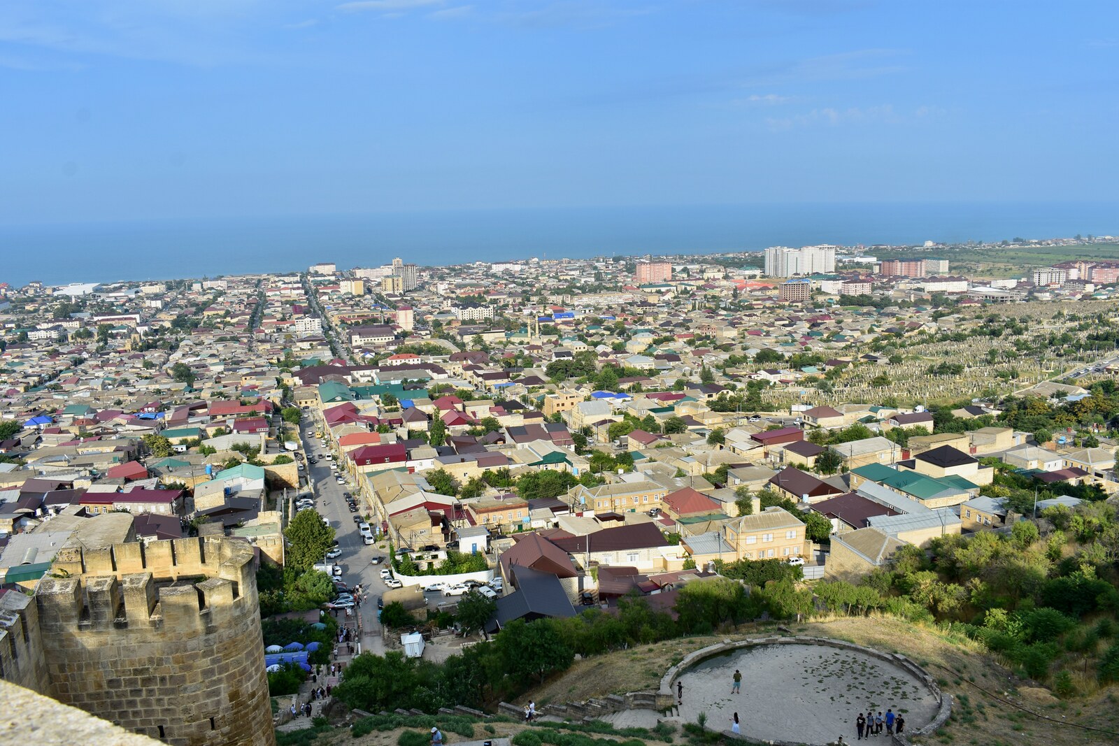
Look around first
What to notice
- Limestone masonry slabs
- Northern city wall
- Middle Persian construction inscriptions
The story of the place
Naryn-Kala is the upper citadel of a vast defensive system. People lived in and fortified this passage long before the citadel appeared, but stone-built Derbent, whose outlines have survived to this day, was constructed under Khosrow I Anushirvan.
In the late five sixties, Khosrow, shah of Sasanian Iran, was preparing the northern border for a clash with the Turkic Khaganate, a new steppe state beyond the Caucasus. Beyond the mountain range lay agricultural regions from which the Iranian treasury received taxes. A breakthrough from the north threatened these lands and the roads to the capital regions.
The Caucasus left the enemy one particularly convenient route. Between the eastern spurs of the mountains and the Caspian Sea stretched a coastal strip about three and a half kilometers wide. A large army could pass south here without crossing high mountain passes. Khosrow ordered this gap to be blocked with stone.
On the hill, the builders raised a citadel. From it, two parallel walls descended to the Caspian Sea, enclosing the city between them. The continuation of the other wall ran from the fortress into the mountains and linked separate fortifications on the slopes. The citadel commanded the whole system from above: the garrison, the gates, and the road were controlled from here. The Persian name of the city, Darband, means “locked gates.”
The earlier fortifications were earthen. The craftsmen working under Khosrow replaced them with masonry of large limestone slabs, with a core of stone and mortar. Construction proceeded in sections and lasted several years. Middle Persian markings showing the dimensions of the completed work have survived on the walls: they were used to check how much masonry the client had accepted.
After construction, Khosrow stationed a permanent garrison here. Persian soldiers served together with detachments of local rulers and were to be the first to meet those advancing from the north. For this service, they were given cultivated plots and exempted from taxes. They lived by the wall and lived off the land they defended.
Craftsmen and merchants settled the strip between the parallel walls. Thus the military arrangement determined the city’s form: commanders and guards were at the top, while below were homes, workshops, markets, and the road through the gates. After the fall of Khosrow’s empire, new rulers kept the garrison and repaired the stone barrier. It was used for about fifteen centuries.
The southern city wall was largely dismantled in the late nineteenth century. The northern wall still descends from Naryn-Kala, and the old quarters occupy the corridor measured out by Sasanian builders. The names of two supervisors of the work remain on the citadel’s masonry. Their inscriptions are extremely brief: “Mushig made it” and “Adurgushnasp made it.”
Useful on site
Daily 09:00–18:00 according to the museum's official notice dated 18.06.2026.
Checked: date not specified. Check the official source before visiting.First, find a safe open area and look over the city without climbing onto closed walls and openings.