 Guide On Map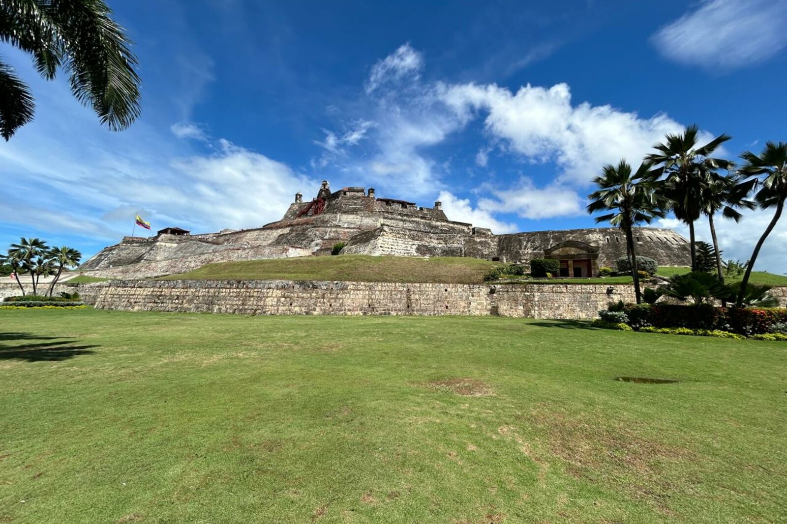
Look around first
What to notice
- Open slope
- Upper redoubt
- Lower belt of walls
- San Lázaro Hill
The story of the place
At first, a small fortified redoubt stood at the top of San Lázaro. Its height allowed the garrison to keep the only land entrance to Cartagena under fire. The lower belt of walls by the esplanade and the present entrance appeared around it later, so different phases of construction came together on one slope. A broad open slope extends between the lower walls and the redoubt.
At dawn on April twentieth, seventeen forty-one, the British general Thomas Wentworth sent infantry across the open approach to San Lázaro Hill. His task was very specific: to take the fort at the summit, open the land route to Media Luna Gate, and let the army into Cartagena.
The fort was built here precisely for that road. From the summit, the only entrance from the mainland lay within firing range. In sixteen fifty-seven, Governor Pedro Zapata de Mendoza ordered a small fortified redoubt built at the top. San Felipe de Barajas was named after the Spanish king Philip IV, while Barajas was the hereditary title of the governor's family. Here, the modern word “castillo” refers to a military fort, not a royal residence.
By the time of the assault, the British had already broken through the fortifications of Bocachica and brought their ships into the bay. Only the landward barrier remained. Wentworth had received the army after the original commander died during the crossing of the Atlantic Ocean; he had had no independent field command before. Now his soldiers were falling ill with scurvy and fevers, the rainy season was approaching, and the army had no draught animals—men carried the cannons, cannonballs, and construction timber themselves.
A proper siege required setting up a battery and breaching the wall. Wentworth decided that the men would fall ill before they finished the work. Admiral Edward Vernon pressed him, so the general chose a night assault. For the sake of surprise, he declined naval fire, divided the infantry between the north and southwest sides of the fort, and sent it from the La Quinta area, more than a kilometer from the target. In the darkness, defectors were meant to show the way.
The British did not notice the Spanish sentry post, and its soldiers raised the alarm. The guides lost their way, one part of the infantry reached the other side of the fortification, and defenders in the outer trenches stopped the attackers before the walls. In several places, the assault ladders did not reach the parapet. At dawn, artillerymen from the city opened fire on the men who remained on the open slope. Then the defenders crossed the bridge that Wentworth had not blocked and struck from outside. The British army lost six hundred eighty-three men killed and wounded.
After the failure, the generals proposed returning to a regular siege and asked Vernon for sailors to carry out earthworks. The admiral refused. The soldiers were withdrawn to the ships, and then the expedition left for Jamaica. The following year, Wentworth and Vernon were recalled to Great Britain; Vernon blamed the defeat on the land commander, and Wentworth blamed the admiral, who had not supported the army.
Wentworth's men did not assault the enormous stone fortress of San Felipe de Barajas that now stands before the entrance. In seventeen forty-one, what rose above the hill was mainly the old upper redoubt—the “bonete,” its outline resembling a cap. Beginning in seventeen sixty-two, the engineer Antonio de Arévalo added the lower stone fortifications. High above the esplanade, the target of that night assault remains; the present entrance and the lower belt of walls appeared only afterward.
Useful on site
Check current hours and tickets on the official Fortificaciones Cartagena website; event-related changes are possible.
Checked: June 26, 2026. Check the official source before visiting.The visit to the complex begins here: follow the current entry procedure and the signs. If the interior is inaccessible, the walls and the position of the upper fort can still be understood from the esplanade.