 Guide On Map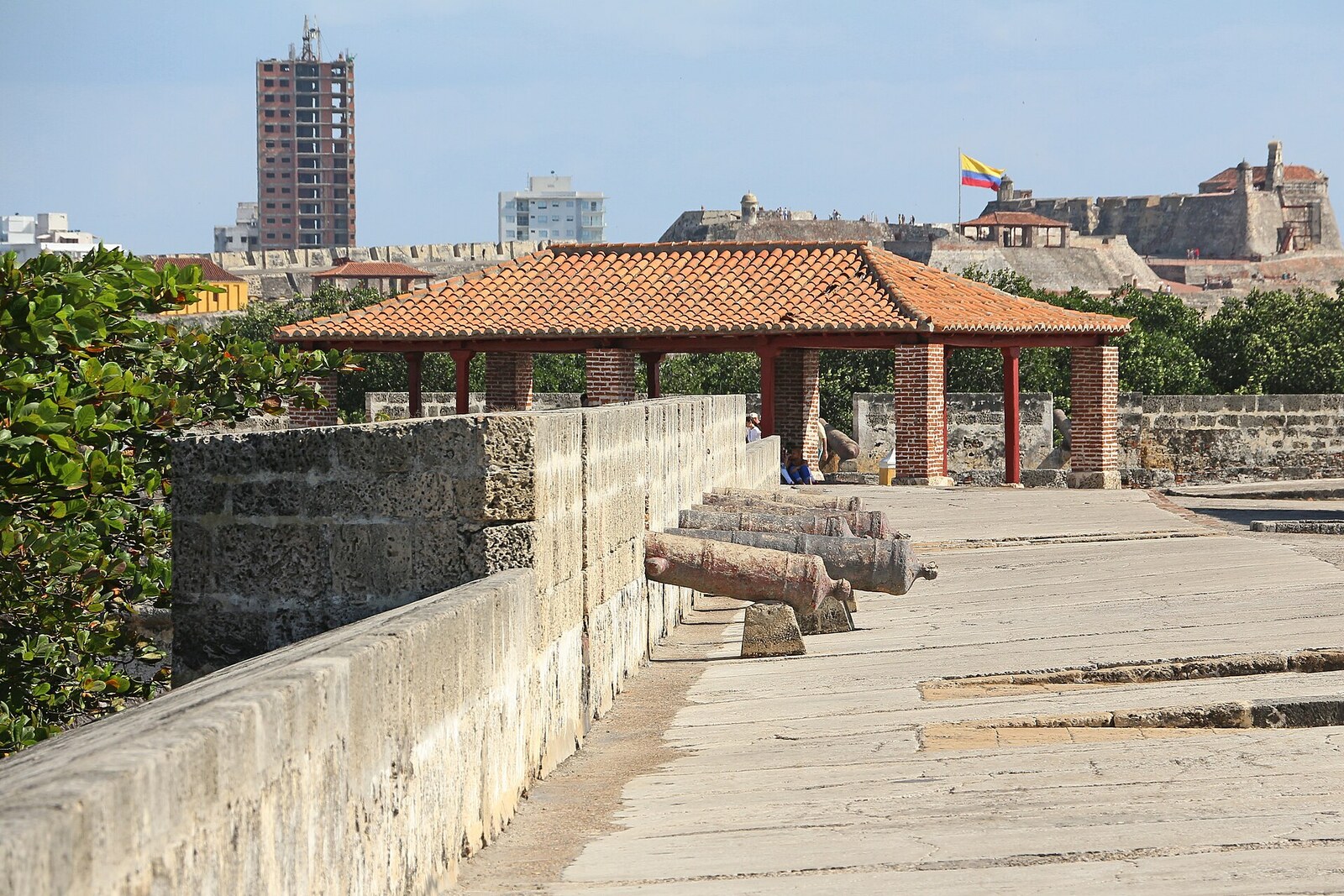
Look around first
What to notice
- The two projecting bastions
- The wall connecting them
- Stone masonry
- Santander Avenue beyond the wall
The story of the place
The northern edge of San Diego was protected by two bastions connected by a wall: Santa Catalina and San Lucas. Santa Catalina faced the open sea, and San Lucas faced the Juan de Angola Channel; Cruz Grande Road lay between the water and the marshy lowland. From their platforms, artillerymen could fire across the road and along the wall, so the pair was called La Tenaza, “The Pincers.” Santander Avenue now runs beyond the wall, laid out over land that did not yet exist here at that time.
Royal engineer Cristóbal de Roda was responsible for this section of wall and tried to build it at the lowest possible cost. He questioned long-time residents and checked the stone markers on the shore: the sea had not reached them for more than twenty years. So Cristóbal de Roda placed the wall farther from the water, went around ancient refuse mounds, and left a dry roadway outside, wide enough for two carts to pass each other. This avoided demolishing neighboring houses and convents or building expensive foundations right at the sea's edge.
The savings affected Cristóbal de Roda personally. At the end of sixteen seventeen, Cristóbal de Roda complained to the Council of the Indies that he received twelve hundred ducats—less than his foreman. The engineer claimed that a single decision sometimes saved the treasury from six to eight thousand, and asked for a higher salary and the rank of captain: without it, people at the construction site obeyed less readily. A few weeks later, he had to explain to the king why part of the new wall was lying on the ground.
On February twelfth, sixteen eighteen, the sea advanced more than a hundred paces beyond its usual boundary and covered the unfinished Santa Catalina Bastion. There was almost no suitable earth on the island, so the wall was filled from the inside with sand. The water soaked it, began pressing on the fresh masonry from both sides, and part of the fortification collapsed. Cristóbal de Roda wrote that a finished wall would have held: it had not yet been given its full height, rounded parapet, waterproof covering, and drains.
By then, work had already slowed because of a shortage of money. Most of the builders were dismissed; Cristóbal de Roda had about fifty hired diggers and masons and twenty enslaved workers owned by the Crown left. After the storm, the engineer and the governor sent drawings of the damage and proposals for a new line of fortifications to Madrid. The changes were approved, the wall was rebuilt, and the northern front was reinforced. Cristóbal de Roda himself did not live to see the work completed.
Two projections in the wall were built here because of the geography. Santa Catalina faced the open sea, and San Lucas faced the Juan de Angola Channel. Between the water and the marshy lowland lay a narrow land approach, Cruz Grande Road. An enemy could come straight to San Diego along it. The bastions allowed artillerymen to fire across Cruz Grande Road and along the wall connecting them. For this arrangement, the pair was called La Tenaza—“The Pincers.” Cristóbal de Roda pushed them farther north than the short defensive line required, and left fertile plots and bodies of water of San Diego within the walls: during a siege, they gave the townspeople water and food.
The bastions' names refer to saints, not engineers or battles. Santa Catalina is Saint Catherine of Alexandria, one of Cartagena's church patron saints and the saint whose name is borne by the city's cathedral. San Lucas is Saint Luke the Evangelist, companion of the Apostle Paul. The Spanish dedicated fortifications to saints; Luke had no historical connection with this shore.
The masonry in front of you belongs to several later rebuildings. In sixteen ninety-seven, French soldiers of Baron de Pointis blew up parts of both bastions. Juan de Herrera y Sotomayor restored them in seventeen nineteen, removed the lower artillery platforms, moved the gates beyond San Lucas, and turned again to the sea: he created a protective strip of shore in front of Santa Catalina. Later, Antonio de Arévalo completed the sea barrier.
Where Cristóbal de Roda left a roadway between the wall and the water, wide enough for two carts, Santander Avenue now runs—over land that did not yet exist in sixteen eighteen.
Useful on site
An open line of fortifications without a regular museum schedule; individual sections may close because of work, weather, safety, or events.
Checked: July 1, 2026. Check the official source before visiting.On exposed stone, keep away from the edge, especially in wind or after rain. If the ascent is closed, compare the viewing directions from street level.