 Guide On Map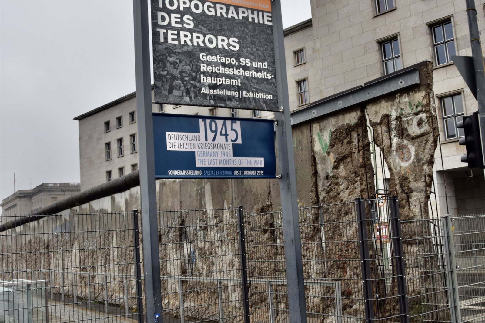
Look around first
What to notice
- A section of the Berlin Wall
- The exhibition trench
- Exposed foundations
- The facade of the documentation center
The story of the place
In the open-air exhibition trench, you can see foundations that lay beneath sand and rubble for a long time. They belonged to different parts of a large complex of Nazi institutions: the School of Applied Arts once stood here, and later the departments that organized persecution and mass murder moved in. The ruined buildings were demolished after the war, so the documentation center tells their story through the surviving traces and exact addresses. Nearby stretches a surviving section of the Berlin Wall: the border ran between the road and the former complex, leaving the address on its other side.
On November twenty-first, nineteen thirty-nine, the carpenter Georg Elser spent nearly fifteen hours answering investigators' questions at Prinz-Albrecht-Straße eight. That was the name of what is now Niederkirchnerstraße. The investigators of the Secret State Police—the Gestapo—already knew what Elser had done. They wanted something else: the names of people who supposedly stood behind him.
Elser earned his living as a carpenter and was used to planning work down to the smallest detail. In the autumn of nineteen thirty-eight, he decided to kill Adolf Hitler and the closest leaders of the Nazi regime because he considered war inevitable and wanted to prevent it. There was no conspiracy. He made the time bomb himself, then spent more than thirty nights secretly hollowing out a cavity for it in a column of Munich's Bürgerbräukeller beer hall, where Hitler addressed his supporters every year.
On November eighth, nineteen thirty-nine, Elser started the mechanism and headed for the Swiss border. There, he was detained before the explosion. A postcard showing the hall, parts of the detonator, and notes about ammunition were found on him. The bomb went off at the appointed time, destroyed part of the hall, killed eight people, and wounded sixty-three. Hitler left earlier than Elser had expected and was unharmed.
After torture in Munich, Elser confessed and described in detail how he had prepared the assassination attempt. The investigators were already leaning toward the conclusion that he had acted alone. The leaders of the regime did not believe this: they needed a conspiracy, preferably one linked to British intelligence. So Elser was brought here and questioned all over again every day from November nineteenth through twenty-third. His relatives were also detained, brought to Berlin, and forced to identify Elser, whose face bore traces of beatings. Elser kept repeating that he had had no helpers.
It was for interrogations like these that the Gestapo occupied the former School of Applied Arts on Prinz-Albrecht-Straße. They set up thirty-eight solitary cells and one shared cell in the basement. People from whom they especially wanted information were placed there; many were brought from other Berlin prisons only for interrogation. “Protective custody” meant imprisonment without trial and without a fixed term. Investigators could hold a person for as long as they saw fit and used torture.
Elser was not put on trial after the Berlin interrogations. He was sent to Sachsenhausen concentration camp as a special prisoner and kept apart from the others for more than five years. The Nazi leadership planned to hold a show trial after victory in the war and present him as a participant in a foreign conspiracy. When Germany's defeat became inevitable, Elser was transferred to Dachau. He was shot on April ninth, nineteen forty-five.
The propaganda version outlived the war: for a long time, Elser was still regarded as a British agent or a participant in a staged plot. In nineteen sixty-four, the historian Lothar Gruchmann found the interrogation records drawn up here. The documents through which investigators had tried to find nonexistent accomplices became the main proof that Elser had conceived and carried out the assassination attempt on his own.
The Gestapo buildings and the neighboring SS leadership institutions were damaged at the end of the war, and their remains were demolished by the middle of the nineteen fifties. The foundations of the prison have been preserved beneath sand and rubble on the grounds of the center; the open basements in the exhibition trench also belong to other buildings in the complex, so not every surviving wall can be considered Elser's cell. He was interrogated in a vanished building on this site. The present documentation center has the same number—Niederkirchnerstraße eight. The name “Topography of Terror” describes the exhibition's method: documents are matched with the exact places where the Gestapo offices, the SS leadership, the prison, and the departments that organized persecution and mass murder were located.
The street itself is named after Käthe Niederkirchner. A Berlin seamstress and member of the communist resistance, she lived in the Soviet Union after nineteen thirty-three. In the autumn of nineteen forty-three, she and Theodor Winter parachuted over occupied Poland: they were to reach Berlin and make contact with local underground resistance members. Both were discovered on the way. Winter was shot at Sachsenhausen, Niederkirchner at Ravensbrück on the night from September twenty-seventh to twenty-eighth, nineteen forty-four. She did not reach Berlin and was not held in the prison here. The East Berlin authorities gave the street her name on May tenth, nineteen fifty-one.
Later, the street ended up in East Berlin, while the former Gestapo site was on the other side of the border, in West Berlin. That is why the Berlin Wall was erected between the road and the vanished building in nineteen sixty-one. After the border opened, staff of the Topography of Terror Documentation Centre secured the preservation of about two hundred meters of damaged concrete. The wall remains on its original line, and beyond it the address Niederkirchnerstraße eight is still listed.
Useful on site
The exhibitions at the Topography of Terror Documentation Centre are open daily 10:00–20:00; outdoor areas—until dark, but no later than 20:00; free admission.
Checked: June 28, 2026. Check the official source before visiting.First distinguish the two layers: the wall stands along the street, while traces of the Gestapo buildings are on the grounds of the complex. You can visit the exhibition separately; the outdoor features are enough for this account.