 Guide On Map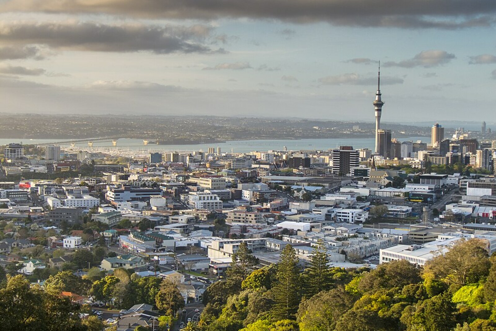
Look around first
What to notice
- The pedestal with the survey mark
- Waitematā Harbour
- Rangitoto
- Sky Tower
The story of the place
Beneath the grass of Maungawhau / Mt Eden, an old volcanic vent remains, and its cone is part of the Auckland Volcanic Field, with fifty-three known eruption centers. Waitematā Harbour stretches to the north; beyond its water rises Rangitoto, the youngest volcano in this field. According to geologists, the old vents here are unlikely to open again: local magma had previously found a new outlet each time.
At the summit of Maungawhau / Mt Eden, a raised platform with a survey mark remains. The white trig beacon above it was removed in September two thousand twenty-four: the wood-and-metal structure had served for more than forty years and had become unsafe. The mark itself is much older. Auckland was once measured from it.
In the middle of the nineteenth century, surveyors laid out the rapidly growing city and vast tracts beyond it, but worked from different baselines. Some boundaries did not match others. In eighteen seventy-two, a fire destroyed the old field books, so some measurements could no longer be checked again. A surveyor's error meant a land dispute and months of repeated work.
The Inspector of Surveys, Theophilus Heale, decided to link the scattered plans through a common network. He was responsible for the accuracy of land surveys and chose Maungawhau / Mt Eden as the starting point: it is the highest natural summit on the Auckland isthmus, visible from other high ground. On August seventeenth, eighteen seventy-two, the Chief Surveyor, Stephenson Percy Smith, set up a stone pedestal here.
From there, triangulation took over. Surveyors measured angles between summits and distant signal markers, building up the area from triangles. The coordinates of each new point were related to the Maungawhau / Mt Eden meridian. By eighteen seventy-seven, Heale reported that all trigonometrical surveys completed under his supervision had been recalculated in relation to this summit; earlier inaccurate plans of land holdings were also tied to the network. Smith continued this work across the North Island, became Auckland's Chief Surveyor, and then headed the entire government surveying service.
The position of the starting point also explains the panorama. The hills around it belong to the Auckland Volcanic Field, with fifty-three known eruption centers. The old vents, including Maungawhau / Mt Eden, are unlikely to open again: local magma emerged in a new place each time. Beyond the harbor rises Rangitoto, the youngest of these volcanoes.
The water to the north is called Waitematā Harbour. A popular translation is “obsidian waters,” but in one tradition of Te Kawerau ā Maki, the name is linked to an act by the ancestor Kahumatamomoe. He placed the obsidian stone Te Matā, on Boat Rock in the upper harbor as a mauri—a sacred pledge of life force. After that, the water came to be called Wai-te-Mata, “the waters of Te Matā.”
Now the sky is open above the old survey mark. Modern surveyors can use the Sky Tower, visible from here among the houses, as a reference point, while Stephenson Percy Smith's pedestal still stands on the summit from which Auckland's coordinate network began.
Useful on site
Access follows Maungawhau gate opening hours; begin your descent with time to spare before the gates close.
Checked: June 28, 2026. Check the official source before visiting.In haze, distant summits may blend together; first find the harbor, then trace the maunga one after another.