 Guide On Map
Miraflores: From Huaca Pucllana to the Pacific Cliffs
From an ancient pyramid through the district center to the lighthouse and Larcomar
Guide On Map on your phone
Open the walk like a regular app
It takes about 10 seconds to install. No app store needed.
The whole path
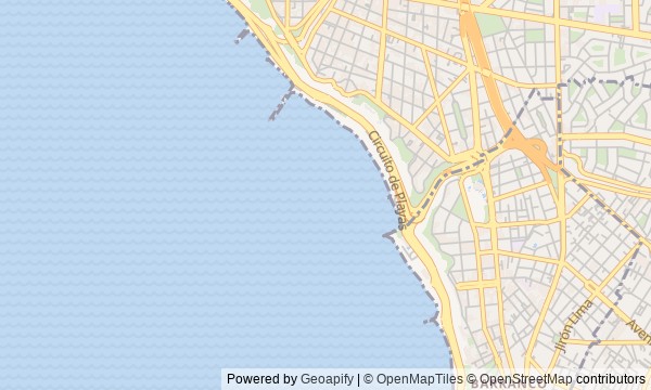
Route map
About the walk
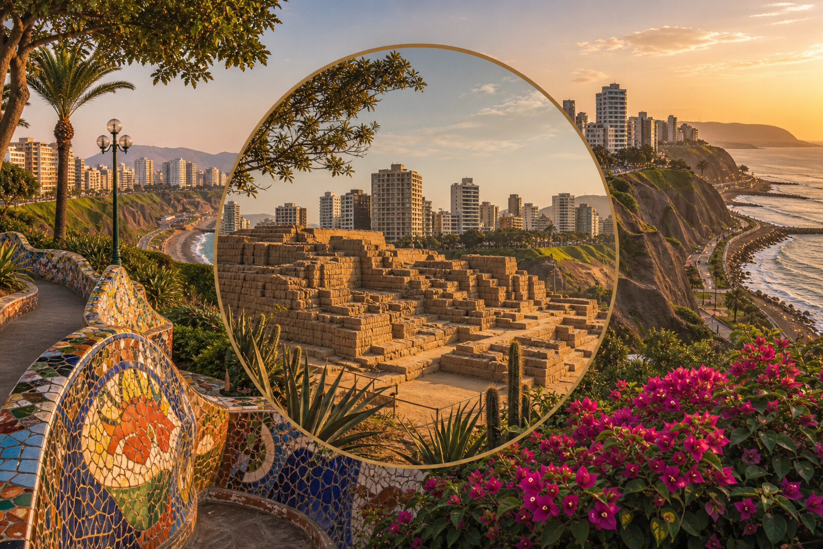
You will begin beside a clay pyramid among residential blocks, pass through the business center of Miraflores, and emerge at the parks above the Pacific Ocean. From there, the route will follow the cliff edge to Larcomar.
Why did the last feast end with broken pottery? How did a charitable exhibition gain a permanent home? Why was a working lighthouse taken apart into hundreds of pieces? And what lies beneath the lawn at the final stop?
In the center, the story grows heavier: an ordinary city street leads to a pedestrian memorial. By the ocean, the protagonists are a cast-iron tower, a public kiss, a transparent wall, and a vanished coastal battery.
The story rests on human decisions, archaeological finds, and the objects in front of you. Assumptions will be kept separate from what is established. By the end, you will read Miraflores in vertical bricks, lighthouse bolts, bridge panels, and the green cover above Larcomar.
Why this order
Huaca Pucllana gives the route its depth: the present-day district begins with a space that builders deliberately concealed beneath a new layer. The walk to Kennedy Park takes you from an ancient setting for shared ceremonies to a modern civic center. Nearby Tarata Street immediately reveals another side of urban community: memory fixed directly into an everyday block.
After that, the route leaves the dense development for a working lighthouse. From that point on, the cliff itself becomes the central argument. Farther south, Love Park shows how the coastal edge became a public place, while the neighboring Mayor Eduardo Villena Rey Bridge reveals the tasks and dangers this terrain creates. Beyond the bridge begins Malecón de la Reserva, whose name returns the coast to its military past. Continuing south brings you to Larcomar, where a park and a commercial complex occupy different levels of the same cliff.
Those who want to understand Miraflores beyond its resort-like facade Lovers of archaeology, urban history, and architectural solutions Those who value specific human stories Those who enjoy routes with clear changes in urban terrain
Those looking only for an easy walk along the oceanfront Those who find stories of a terrorist attack and people in crisis difficult to hear Those who do not enjoy noticeable walks between story points
Before you go
Treat entry to and exploration of Huaca Pucllana as a separate visit: this walk lets you view the complex from the accessible outer perimeter, but it does not replace going inside. If you want to enter the site, check the current rules with the complex itself in advance.
Bring water, sun protection, and an extra layer for the cool ocean wind. Along the waterfront promenade, stay on marked paths, yield to cyclists, and follow any temporary barriers. Do not feed the cats random food or try to pick them up: an animal that appears calm may be sick, frightened, or under the care of volunteers.
When to go
It is best to set out with plenty of daylight to spare: the city section rewards unhurried looking, and the ocean stretch is noticeably longer than it seems on the map. Later light is especially striking on the coast, but the popular viewpoints and Larcomar usually feel livelier toward the end of the day.
Backup plan
If the Huaca Pucllana grounds are inaccessible, limit yourself to views from the permitted points outside and continue to Kennedy Park—the sequence of the story will remain intact.
If a stretch of the waterfront promenade is closed or work is underway by the slope, do not climb over barriers or look for a path along the cliff. Return to the nearest open city passage and continue along a safe parallel route.
If the northern approach to the lighthouse proves too long, turn south after the bridge. Malecón de la Reserva and Larcomar will preserve the closing conversation about risk, memory, and the cost of the ocean's edge.
Route conditions
Surface. Paved — 4 km (data covers 91% of the route)
Stairs. Flights: 3, 28 m in total
Access. Wheelchair — no; stroller — limited (stairs)
Facilities. Toilets — 5
Elevation. Ascent — 27 m; descent — 56 m
OpenStreetMap extract of June 18, 2026: database data, not a check on the ground. Data © OpenStreetMap contributors, ODbL licence
Walk plan
Open in maps ↗- 1
Huaca Pucllana
Here you will see how a communal feast accompanied the destruction of an old courtyard and the construction of a new tier. - 2
Kennedy Park
This stop will show how one-time aid to those affected secured a permanent place in the city for artists. - 3
José Larco Avenue and Tarata Street
This stop connects a commercial street with the memory of an attack that changed this neighborhood. - 4
La Marina Lighthouse Park
Here, a working navigational beacon connects two distant stretches of the Peruvian coast. - 5
Love Park
Here it becomes clear how a municipal commission turned a public kiss into the norm for a particular place. - 6
Mayor Eduardo Villena Rey Bridge
This stop will show how a protective barrier gave rescuers time for a complex operation. - 7
Malecón de la Reserva
Here, the name of the waterfront will preserve the memory of the civilian battalions and the coastal battery. - 8
Larcomar
Here, a park, shopping galleries, and the memory of a pilot will occupy different levels of the same site.
Route features
Everything you need stays in the browser
Progress, saves and your trip plan are stored on this device.
Add Guide On Map to your home screen so the walk opens outside the browser.
How we handle sources, maps and corrections: our editorial standards