 Guide On Map
Barranco: Urban Life Above the Ravine
From Barranco Municipal Park to the viewpoint and the Dédalo Arte y Artesanía casona
Guide On Map on your phone
Open the walk like a regular app
It takes about 10 seconds to install. No app store needed.
The whole path
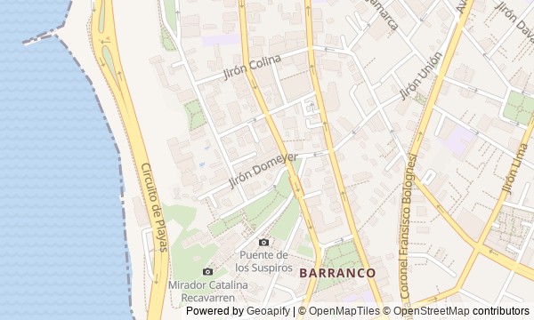
Route map
About the walk
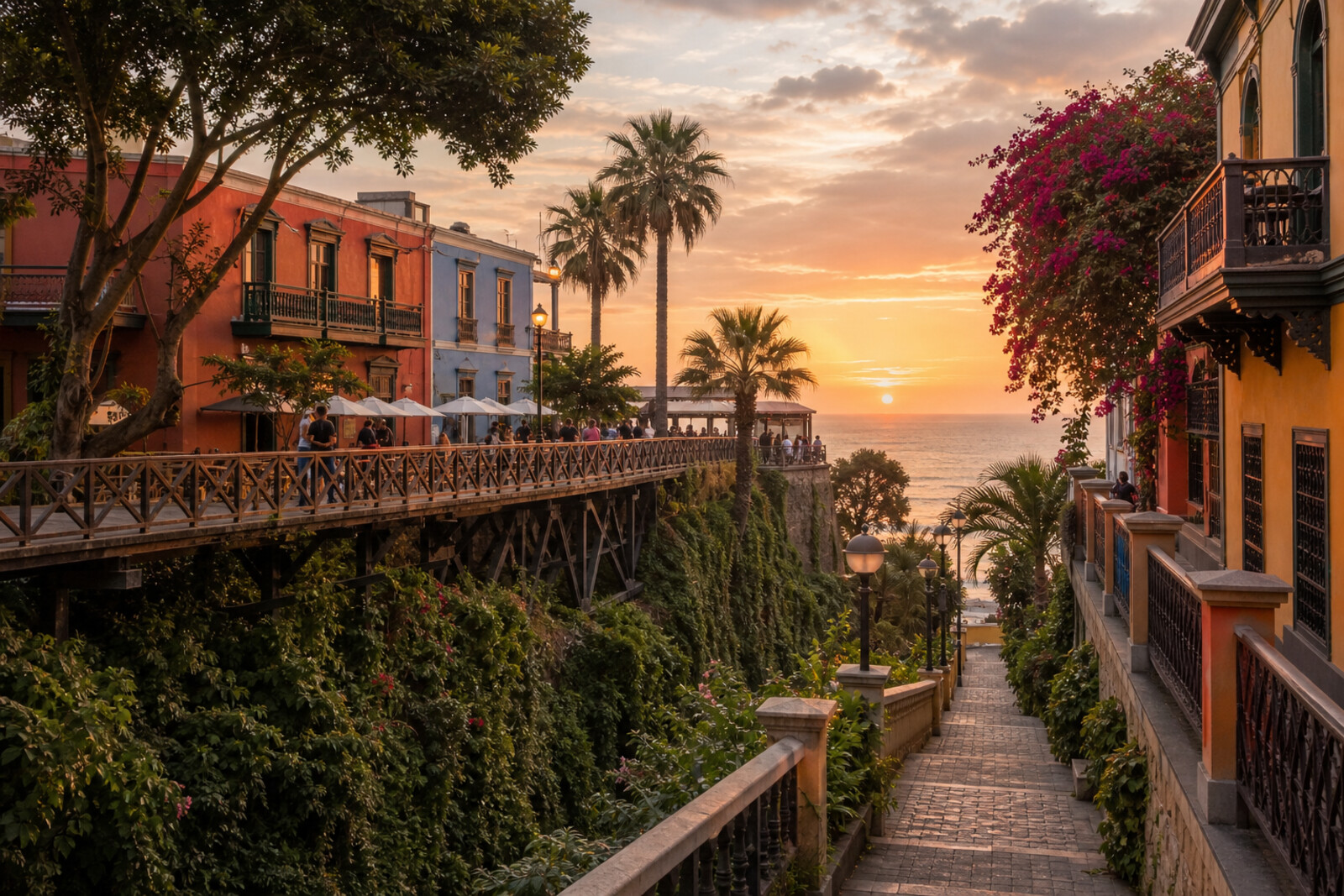
You will begin in Barranco Municipal Park, beside the former town hall and the Montero Pergola, and finish in a casona where the work of contemporary makers is sold. Between them, the route follows the old seaside suburb: past a private collection, down the ravine, across a wooden bridge, to the closed La Ermita and a platform above the Pacific Ocean.
This is Barranco not as a backdrop for photographs, but as a neighborhood its residents arranged for themselves again and again. Why did one employee miss dances for 8 years? How did a descent preserve the name of vanished bathhouses? What proved stronger than the bridge's old names?
The story rests on such small decisions. It separates documents from legends and connects them to the things before you: clocks, balusters, locked doors, a commemorative plaque. By the end, you will be able to read Barranco through its park, ravine, and casonas—and explain why a carnival fund, a municipal archive, a song, and a strict selection of handmade work lie behind them.
Why this order
The park introduces the idea of shared urban space, while the former town hall at its edge immediately shows who recorded the neighborhood's life. From the library, Pedro de Osma Avenue leads to a private residence: after the municipal archive, another way of preserving the past comes into view—a personal collection. From the house in the old seaside suburb, the route returns to its historic way down to the water, Bajada de Baños, and Barranco's origins emerge in the terrain itself. The descent passes beneath the wooden bridge, so you first untangle the road's vanished purpose and then the crossing above it. The bridge leads directly to La Ermita: a name made famous in song stands beside the church around which the settlement grew. Beyond the church, the same edge of the ravine becomes the Catalina Recavarren Viewpoint, named for a poet. From this public tribute, the route continues north to Dédalo Arte y Artesanía, where the final note comes not from a commemorative plaque but from a casona filled with work by living artists.
Those who want to understand Barranco as a lived-in, civic neighborhood People who prefer human stories to a list of dates Anyone interested in casonas, the urban ravine, and the fate of familiar names
Those looking to see all of Lima in a single walk Those who want a route devoted only to pre-Columbian Peru Those who prefer individual sights without a connected story
Before you go
Wear shoes with a secure grip on slopes and wet paving: you will walk down Bajada de Baños, then make up that descent with a climb. Bring water, sun protection, and a light extra layer for the cool ocean air. The library and La Ermita can be understood from outside, but access indoors is not guaranteed. The Pedro de Osma Museum needs separate time and an advance check of visiting conditions; do not expect to take in its collection in passing. It is also worth checking access to Dédalo Arte y Artesanía beforehand if the interior rooms and courtyard matter to you. On the bridge, leave room for people passing by, and do not lean on the railings for a photo.
When to go
It is best to take the route in daylight: uneven ground on the descent is easier to see, the ravine is easier to study, and the coast is clearer from the viewpoint. The pace is set not by the first stops but by the stretch by the ocean, the climb back up, and the 2 artistic spaces at the end. If you plan to visit the Pedro de Osma Museum, build the start of your walk around a confirmed museum visit and leave extra time for the galleries. With an outside-only look, the route will be substantially quicker, though the square, bridge, and Bajada de Baños still deserve unhurried time.
Backup plan
If the slope is slippery, the heat is tiring, or the descent feels too steep, after La Ermita view Bajada de Baños only from above and continue along the upper streets to the viewpoint, or go straight to the final stops. The seaside stretch is not essential to understanding the route: the ravine's history is already legible in its shape and direction. If the museum is closed, limit yourself to viewing the mansion from the public street without going beyond the barriers, and give more time to Dédalo Arte y Artesanía if it is open to visitors. If that is unavailable too, end with an outside view of the old house: the final idea still holds in the shift from a collection of the past to a place made for contemporary artists.
Route conditions
Surface. Paved — 1.7 km; unpaved — 43 m (data covers 90% of the route)
Stairs. Flights: 3, 141 m in total
Access. Wheelchair — no; stroller — limited (stairs)
Facilities. Toilets — 1
Elevation. Ascent — 28 m; descent — 25 m
OpenStreetMap extract of June 18, 2026: database data, not a check on the ground. Data © OpenStreetMap contributors, ODbL licence
Walk plan
Open in maps ↗- 1
Barranco Municipal Park
Here you will learn how an exclusive celebration for affluent families was turned into a citywide event. - 2
Manuel Beingolea Municipal Library
You will find out how a municipal employee compiled the district’s history from an incomplete and biased archive. - 3
Pedro de Osma Museum
Private drawing rooms help trace how a personal collection gradually gained permanent public access. - 4
Bajada de Baños
The descent will trace the route from a fishermen’s path to seaside baths and the coastal road. - 5
Puente de los Suspiros
You will hear how a song displaced the former names of an ordinary pedestrian crossing from the city’s memory. - 6
La Ermita Church
The history of the chapel links a local legend, wartime devastation, and long-running efforts to return the church to the community. - 7
Catalina Recavarren Viewpoint
You will learn how a public tribute to a poet appeared here before the viewpoint itself. - 8
Dédalo Arte y Artesanía
The finale will show how rigorous selection in a shop changed both customers’ expectations and the work of makers.
Route features
Everything you need stays in the browser
Progress, saves and your trip plan are stored on this device.
Add Guide On Map to your home screen so the walk opens outside the browser.
How we handle sources, maps and corrections: our editorial standards