 Guide On Map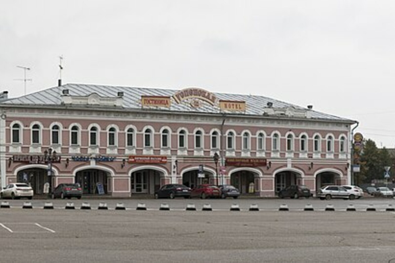
Look around first
What to notice
- Open space in front of Cathedral Bridge
- Stone trade rows
- Kazan Church
The story of the place
The broad space in front of Cathedral Bridge, stone trade rows along its edges, and Kazan Church bring the former city market together into one square. Its eastern half took its name from the Church of the Assumption, which stood on the road to Yaroslavl beside Kazan Church. Traffic passed through this part of the city toward the Kremlin and onto the main road: one crossing went over the moat, while the other led across Kamenny Stream.
In August eighteen oh three, several Uglich merchants and townspeople engaged in small-scale trade were left without a place to sell. They sold goods from chests and tents at the city’s main market. The authorities ordered these structures demolished, and the traders could not take part in building the stone trade rows. In their petition, they explained their situation plainly: “we have no place to conduct trade,” and therefore suffer “the greatest misfortune, a decline in our circumstances.”
They asked the City Duma to allow small wooden shops near the Church of the Assumption. For these people, a counter meant daily earnings, but they could no longer set one up as they saw fit. Under the general plan of seventeen eighty-four, the old Lesnaya, Sennaya, and Khlebnaya Squares were being combined into a regular city center with straight streets and prescribed facades. Even an inexpensive wooden shop had to fit the approved drawing.
The Duma forwarded the request to Mikhail Golitsyn, the governor of Yaroslavl, on whose permission it depended. Golitsyn agreed, but forbade the traders from selling the shops once they had been built. If someone gave up a site, the city could transfer it to another interested person or charge a fee for its own benefit. In March of the following year, the petitioners received a plan and facade drawing. On the city plan of eighteen seventeen, a triangular wooden trade building is already marked in front of the Kremlin’s Cathedral Bridge. The later fate of each petitioner is unknown; the place for trade that they requested appeared.
While this petition was being considered, Golitsyn ordered three more bridges, a municipal drinking house, and meat, bread, and kalach shops to be established in Uglich. Two bridges directed traffic through this part of the market: one led across the moat into the Kremlin, and the other crossed Kamenny Stream at the beginning of Yaroslavl Road. Small counters, the entrance to the fortress, and the roads along which goods were brought to the square all appeared in one case.
The Church of the Assumption served in the petition as a landmark everyone understood. The Assumption is the church name for the death of the Mother of God; the church dedicated to this event gave its name to the eastern half of the trading center. The western half was called Kazanskaya after the neighboring Kazan Church. During the Soviet decades, Uspenskaya became Commune Square; later, its former name was restored.
The church itself stood at the beginning of Yaroslavl Road, beside Kazan Church. It was closed in nineteen twenty-seven and destroyed in the nineteen thirties. The triangular building secured by the traders also disappeared. Open space now remains in front of Cathedral Bridge; shops occupy other surviving stone trade rows. From the church beside the old shops, the square’s name has survived.
Useful on site
Urban space with no visiting hours.
Checked: June 24, 2026. Check the official source before visiting.View the square from the surviving rows: this makes it easier to compare their small scale with the vanished trading center.