 Guide On Map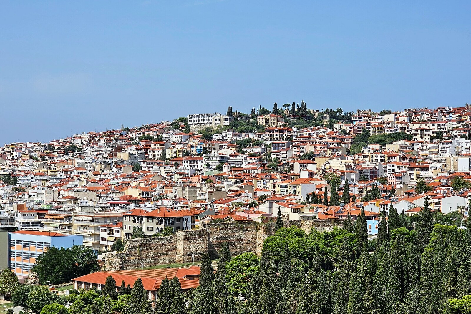
Look around first
What to notice
- Facade of No. 25
- Narrow lanes
- Small courtyards
- Houses by the fortress masonry
The story of the place
Ano Poli means the Upper Town. Here, streets climb the slope, curve around courtyards, and branch into narrow passageways between houses. The Great Fire of nineteen seventeen destroyed two-thirds of Thessaloniki, but the fire did not reach most of this neighborhood. While planners laid out new streets below, old lanes and property boundaries survived on the upper slope.
Until nineteen twelve, Ano Poli was predominantly a Muslim residential neighborhood. After the war, the population-exchange agreement divided people by religion: Orthodox Christians from Turkey were resettled in Greece, and Muslims from Greece in Turkey. The vacated houses on the slope became homes for refugees from Asia Minor.
Among them was a girl named Loukia Pistikidou from Bursa. Her mother sought a roof over the family's heads and went to the Refugee Settlement Commission on the very first day. They were given half a room in a former Ottoman school on Theofilou Street. The other half was already occupied by a family of four. Blankets and sheets were hung between them.
Loukia's mother cashed a few more bonds, bought boards, and put up a partition about two meters high. One of the windows was converted into a sink; the water was led outside into the courtyard. They cooked on a brazier. The two doors of the former classroom allowed each family to enter separately. In this way, the schoolroom became two homes for people who had nowhere else to go.
The same work was happening throughout Ano Poli. Large Ottoman houses were divided among several families, courtyards were partitioned off, and vacant scraps of land were built over. Some plots ended up smaller than forty square meters. Refugees built houses from wood, clay, reeds, and stone from old structures; by the city walls, they attached dwellings directly to the masonry. They were called kastroplíkta—houses pressed against the fortress. The new residents fitted every room and staircase to the existing lanes and steep terrain.
The former school has survived at number twenty-five Theofilou Street. In Loukia Pistikidou's recollections, it has a different address—number twenty-seven Theofilou Street. It was behind this very facade that her mother once measured out half a classroom for the family.
Useful on site
Open residential neighborhood; it is best to go in daylight or early evening, because the stairs and slopes are uneven.
Checked: June 24, 2026. Check the official source before visiting.This is a residential neighborhood, not a museum quarter: do not enter courtyards or building entrances without an invitation, and do not photograph residents in close-up. On the slopes, choose steps and lanes according to the condition of their surface, not only by the shortest line on the map.