 Guide On Map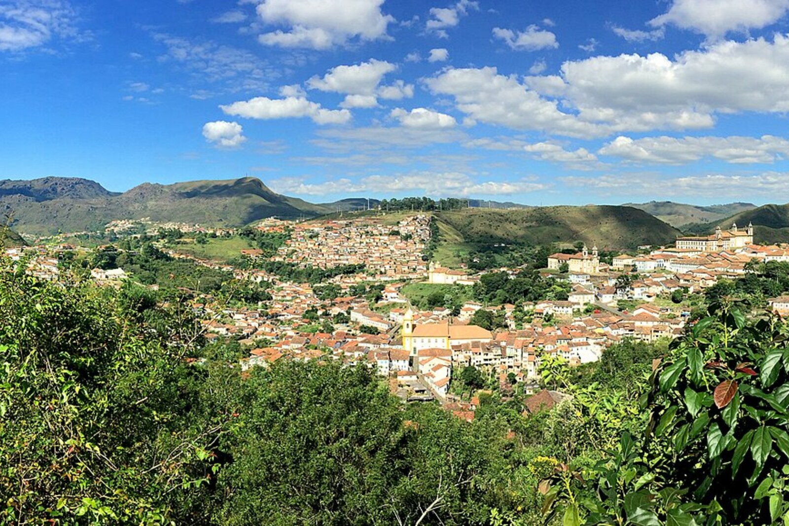
Look around first
What to notice
- Stone parapet
- Lajes slope
- Roofs of Antônio Dias
- Church towers
The story of the place
Lajes was named after the local quartzite: this stone splits easily into flat slabs. The old path crosses the mining slope above Antônio Dias, and its edge is now marked by a stone parapet. An old underground working has survived beneath the neighboring street, while what was mined from the mountain was carried downhill, to where the city was expanding. Church towers and public buildings, paid for with the gold of these slopes, rise above the tiled roofs.
In seventeen oh four, Pascoal da Silva Guimarães, a former peddler, took over an abandoned mining claim on the Lajes slope. Its former owners, the Camargo brothers, had left during a famine, and under the rules of the time an unworked claim could be transferred to someone else. When they returned, the Camargos demanded the land back. Pascoal refused and held the mine by force.
His calculation proved correct. Gold in the streams farther down the slope had already grown scarce, but Pascoal decided that its source must lie higher up, inside the mountain itself. Along the Lajes path, he reached a rich deposit where the metal separated easily from the rock. Hence the name Ouro Podre—“Rotten Gold”: the loose gold-bearing layer, which could be quickly broken apart, was called rotten.
Pascoal did not break it apart himself. Within just a few years, he owned about three hundred enslaved people. They cut water channels, washed away the soil, and crushed the rock. Pascoal had previously earned his living as an itinerant trader, but here he became Vila Rica’s largest mine owner. He acquired shops, farms, and a military rank; the surrounding settlement was called Morro do Pascoal—Pascoal’s hill.
In seventeen nineteen, the king ordered the circulation of gold dust to be prohibited. Everything extracted was to be handed over to smelting houses, made into stamped bars, and one fifth given to the crown. Gold dust served as money in Vila Rica, so Pascoal was risking both part of his output and the freedom to dispose of it as he wished.
The following year, he became one of the leaders of the uprising against the new rules. Armed men came down from Ouro Podre into the town and demanded the abolition of the smelting houses. The governor, Pedro de Almeida, Count of Assumar, initially suspended their establishment and spoke of a pardon, but then sent soldiers at night to arrest the leaders.
Pascoal’s son, João da Silva Guimarães, ordered the inhabitants of the hill to arm themselves and free his father. Pascoal was already in custody and told his son to stop gathering people, fearing a harsher reprisal. The order came too late. Assumar brought a detachment into Vila Rica and ordered the homes of Pascoal and his supporters burned. Felipe dos Santos, a trader and mule driver who tried to rally people to free those arrested, was captured and executed. Pascoal was sent through Rio de Janeiro to Lisbon; after that, his fate disappears from reliable documents.
Today’s Lajes Lookout is a parapet beside the old path above Antônio Dias. “Lajes” means stone slabs: the local quartzite splits easily into flat layers. Beside the parapet itself, there are no houses of Pascoal’s and no traces of the fire. The burned settlement lay farther along the slope, which after the reprisal came to be called Morro da Queimada—the Burned Hill. Nearby, however, in the Palácio d'Ouro complex, an underground working known as Mina do Pascoal has survived. A street runs above it, and from behind the parapet you can see the churches and public buildings of a city that grew on the gold carried down this slope.
Useful on site
Open lookout point, free entry, access 24 hours.
Checked: June 24, 2026. Check the official source before visiting.Do not look for one mandatory spot for a photo, and do not enter private property. Let your eyes adjust to the terrain: the buildings become easier to understand when you trace the roads between them.