 Guide On Map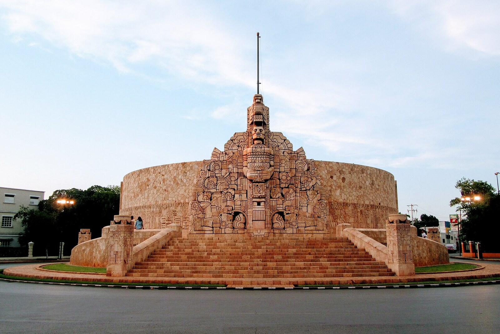
Look around first
What to notice
- Stone semicircle
- Figure of the Fatherland
- Ceiba relief
- Rows of historical figures
The story of the place
At the northern end of Paseo de Montejo, a stone arc gathers Mexican history into a single wall. In deep relief, amid projecting blocks, conquerors, monks, independence fighters, reformers, and revolutionaries stand side by side. In the middle, the image of the Fatherland and a ceiba can be made out, with scenes from different eras radiating from the ceiba. Above this wall, the Mexican flag is raised because it serves as a monument to the entire country.
The stone semicircle before you grew out of a dispute between two authors, and traces of that dispute cover almost its entire surface.
In nineteen forty-three, the Yucatecan architect Manuel Amábilis won a competition for a monument to the Mexican flag. It was to stand in an entirely different place—where Avenida Itzáes and Avenida Colón met at a right angle. Amábilis designed a smooth semicircular wall. A broad frieze with allegories of different eras was to run along its base. At the center of one side, the architect placed a female figure of the Fatherland, and on the other, a ceiba from which scenes of Mexican history radiated.
The Colombian sculptor Rómulo Rozo was invited to do the carving. He was given the role of executor, but in his model he changed the very concept. Instead of a smooth surface, Rozo showed stonework made of projecting stones, and he replaced generalized allegories with recognizable historical figures. This is how conquerors and monks, participants in the struggle for independence, reformers, and revolutionaries appeared on the wall. A monument to one symbol was becoming a stone history of the entire country.
The administration of Governor Ernesto Novelo Torres approved Rozo's model and moved construction to the northern end of Paseo de Montejo. Amábilis tried to reclaim the competition design because both his government commission and his right to call himself the author were at risk. At the end of nineteen forty-five, he was removed from the project. What remained from his earlier work were the foundations, drainage, and the basic outline of the semicircle.
The redesign increased the cost roughly tenfold and stretched construction out for more than a decade. Rozo continued carving the stone through several changes of governor. In January nineteen forty-six, an official report already called the structure Monumento a la Patria—a monument to the Fatherland.
When the opening was near, Amábilis published a letter in a newspaper. He listed Rozo's changes, refused to recognize the carving as part of his project, and recalled that the government had terminated his contract. Two months later, in April nineteen fifty-six, the monument was opened under Rozo's name.
The smooth wall Amábilis argued for is not here. The semicircle, the Fatherland, and the ceiba he conceived remain; between them, Rozo arranged rows of specific people and events. That is why the Mexican flag is still raised above the monument, and why it is called a monument to the entire Fatherland.
Useful on site
The monument is always visible from the outer sidewalk of the traffic circle; the central plaza is surrounded by heavy traffic.
Checked: date not specified. Check the official source before visiting.View the carving from the outer side of the traffic circle, and do not approach the monument through the flow of cars. The details are best read gradually as you walk around the accessible outer perimeter.