 Guide On Map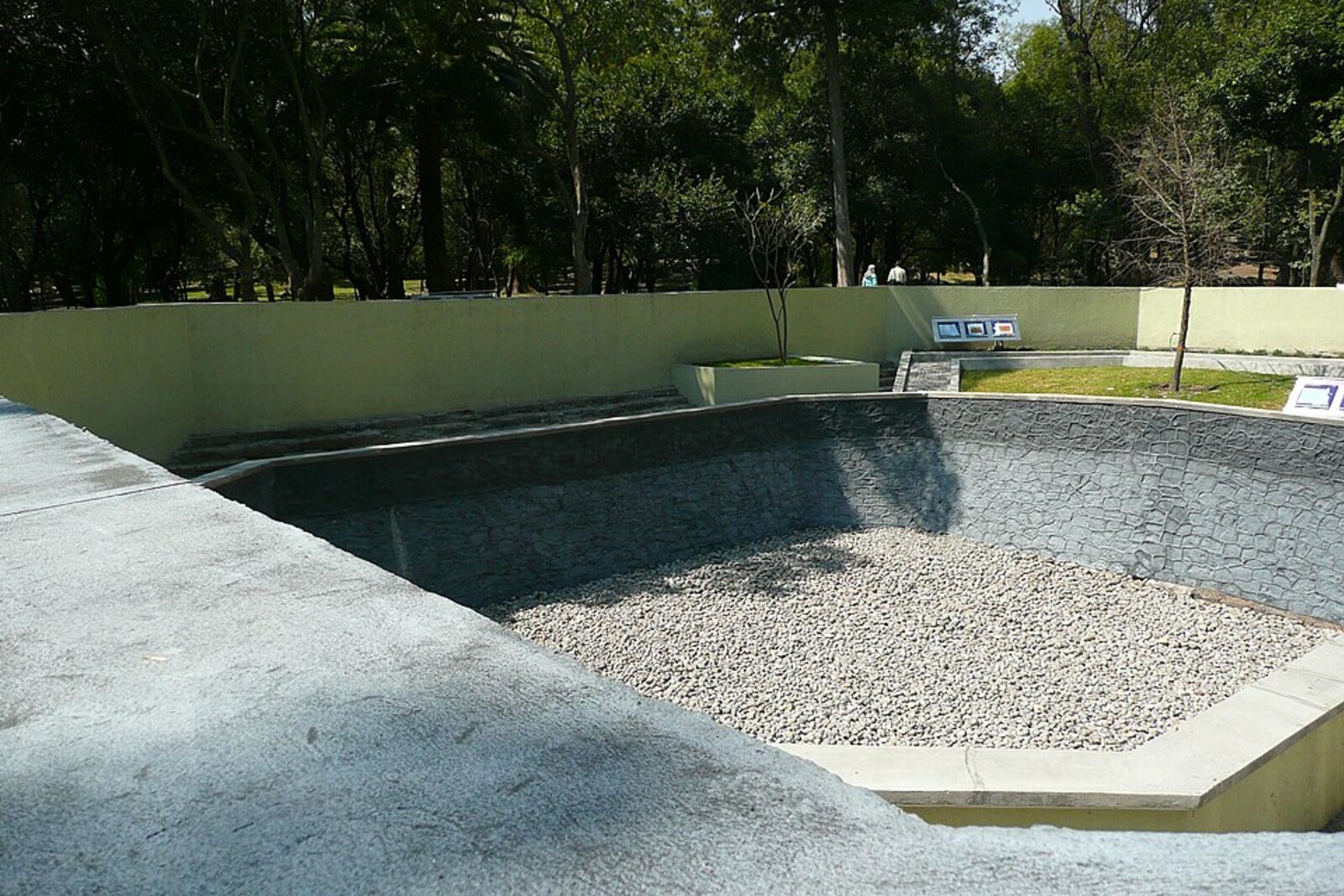
Look around first
What to notice
- Stone bowl of the catchment basin
- Reservoir walls
- Steps to the catchment basin
The story of the place
From the ancient water network at the foot of Chapultepec, a stone catchment basin remains: its bowl, walls, and steps are visible above ground. In pre-colonial times, water descending from the hill collected here and traveled through connected canals to properties south of Chapultepec. After the Spanish conquest, this network did not disappear and continued to supply city estates. Beneath the area in front of the reservoir lie traces of three pools and an inlet canal; excavations also uncovered fragments of red-orange tile.
On April first, eighteen seventy, the landowner José Amor y Escandón opened a paid bathhouse here—the Casa de Baños de Chapultepec. He obtained the right to use the catchment basin, then known as the Espinosa Pool, noticed that city residents willingly came to the springs, and decided to make money from water believed to be healing.
An old water-supply system determined the location of the bathhouse. Water flowed down from the hill by gravity, filled reservoirs connected by canals, and from here went to estates south of Chapultepec, including Congreso. The catchment basin had existed since the pre-colonial era and continued to serve after the Spanish conquest. It was not the ruler's personal bath.
Escandón built the bathhouse building in front of the reservoir and brought a separate canal to it. Pools were installed inside, and the rooms were divided for men and women. The owner's income depended on a single flow of water: as long as the water reached this place, visitors paid to bathe.
But city administrators needed to fill the public water system. They repaired the reservoirs, built dams, and directed more water into the aqueduct. Escandón filed a complaint: after this work, the flow no longer reached his pools, and the bathhouse had to close. He argued that his establishment also benefited the health of city residents, but the water was not returned to him. By August eighteen eighty-one, the place, recently fashionable, had already become deserted.
The Escandón family sold the plot to the city council. Officials demolished the bathhouse building and added the land to the park, preserving the catchment basin. In nineteen ten, when Chapultepec was being prepared for the centenary of Mexico's independence, it was this basin that they called Baños de Moctezuma. That is how the later legend arose of the personal bathhouse of Moctezuma Xocoyotzin, ruler of Tenochtitlan.
In nineteen eighteen, archaeologists found the remains of Escandón's actual baths in front of the catchment basin: three pools set in a row, an inlet canal, and fragments of red-orange tile. These pools remain underground. On the surface stands the reservoir from which water flowed into them—with the name of the ruler who, according to researchers, did not bathe here.
Useful on site
According to the schedule for the first section: official sources differ between 06:00–17:00 and 05:00–19:00, extending to 20:00 in summer. Plan a daytime visit from Tuesday through Sunday and check the notices at the entrance; Monday is usually unsuitable.
Checked: June 29, 2026. Check the official source before visiting.View the structures as parts of different water systems: the name combines an ancient reservoir with a nineteenth-century bathing business.